


Working With GIS
85
GIS Options
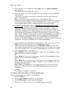
GIS Layer Options
You can customize the default settings for managing GIS layers.
To Set GIS Layer Options
Use the following steps to create default settings for GIS layers.
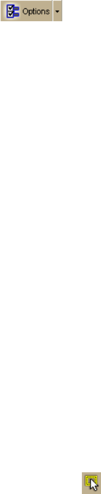
1. Click the Options button
on the toolbar.
OR
Click the arrow next to the Options toolbar button to open the menu. Then,
click Options to open the dialog box.
2. Click the GIS tab, and then click the Layers subtab.
3. Set the following options:
• Add imported layers to Workspace–Select this check box to
automatically add imported layers to the Workspace subtab.
• Show imported layers on map–If you selected the above check box,
select this check box to show layers on the map after they are
imported to the Workspace subtab.
• Show layers added from Manage Layers on map–Select this check
box to show layers on the map when you add them from the Manage
Layers dialog box.
• Zoom map when centering on points–Use the drop-down list to
select the zoom level to use when you double-click a point geometry to
center it on the map in the Attributes subtab Datasheet View.
• Default attribute records filter–Use the drop-down list to select the
default setting for the Show drop-down list on the Attributes subtab for
layers added to the Workspace. You can manually change the filter
after a layer is added to Workspace. Options are Mag Region (default),
All, and Toolbar Select.
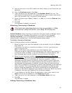
• Refresh attribute records for Map Region filter–Select this check
box to automatically refresh the Attributes subtab Datasheet View
when the map extent changes and Map Region is selected in the Show
drop-down list. The Map Region filter hides all attribute records whose
map bounding region (MBR) is not currently within the map window.
• Large layer definition (# of geometries)–Type the minimum
number of geometries a layer must include to define it as a large
layer. When a layer includes at least that number of geometries, XMap
will handle the layer differently to improve processing speed. For
example, the map will not zoom to the location of the geometries and
the count function for query results is suppressed. The default number
of geometries for a large layer is 50,000.
• Geometry selection color–Click the button to open the Color dialog
box and click the color for selection highlights on the map. Select
geometries with the Selection Tool
in the toolbar or by selecting
records on the Attributes subtab in datasheet view.