


XMap User Guide
30
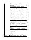
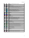
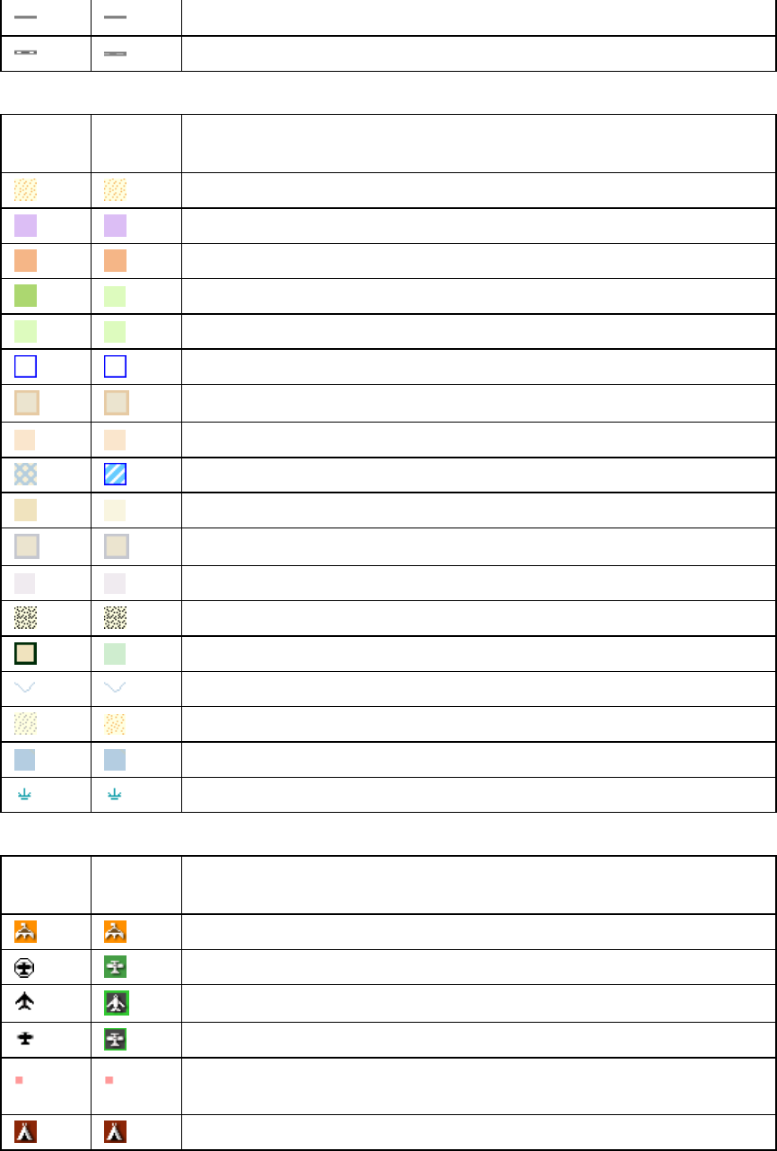
Unclassified Road
Unimproved Road
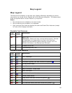
Land Cover
Topo
Colors
Street
Colors
Description
Bare Rock or Sand
Bureau of Land Management Land
Bureau of Mine Reclamation Land
Forest, evergreen
Forest, mixed
Ice or Snowfield
Indian Reservation (at data zoom level 11)
Indian Reservation (at data zoom level 2 thru 10-7)
Intermittent Water
Land
Military Area (at data zoom level 11)
Military Area (at data zoom level 2 thru 10-7)
Mine or Quarry
Parks
River/Stream
Transitional Area, Lava, Salt Flats, or Mixed Barren
Water
Wetlands
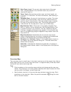
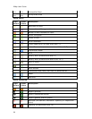
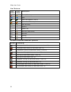
Point Features
Topo
Colors
Street
Colors
Description
Amusements
Airport (private)
Airport (commercial public)
Airport (general aviation public)
Business (Amusement, Recreation, Specialty or Department
Store)
Camping (at data zoom level 14)