


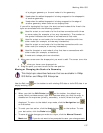

Working With GIS
137
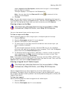
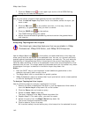
of a polygon geometry or the end node of a line geometry.
Used when the edited shapepoint is being snapped to the shapepoint
of another geometry.
Used when the edited shapepoint is being snapped to the edge of
another geometry when there are no shape points.
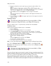
If you edit a topological line layer, the start and end nodes of the lines in the
layer are annotated with the following symbols:
Used for a start or end node of a line that has connections with three
or more nodes (for example, a four-way intersection). The number on
the symbol indicates the number of connections at that node.
Used for a start or end node of a line that has connections with two
other nodes (for example, a three-way intersection).
Used for a start or end node of a line that has connections with one
other node (for example, a two-way intersection).
Used for the start or end node of a line that has no connections with
other nodes (for example, a dead end).
A node and a shape point are coincident.
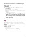
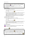
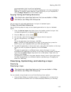
3. Move your cursor over the shape point you want to edit. The cursor turns into
a
when you hover over shape points.
4. Drag the point you want to edit to the new position.
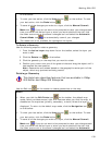
Moving or Changing the Scale of a Geometry
This Help topic describes features that are available in XMap
GIS Editor and XMap GIS Enterprise.
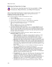
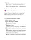
Use the Edit tool
on the toolbar to edit existing GIS data or build GIS data in an
empty/existing layer.
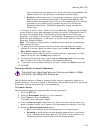
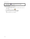
Notes
• When you click the Edit Points tool
on the toolbar, the default map
mode, which provides several right-click features when you click the map, is
disabled on the map area (primary, secondary, or both) where the layer is
displayed. To return to the default map mode, click the Navigation tool
on the toolbar.
• To undo your last action, click the Undo button
on the toolbar. To redo
your last action, click the Redo button
.
• To save all of the changes you make to a layer, click the Manual Commit
Mode tool
. If you do not want to be prompted to save your changes each