1
Getting Started
Welcome to XMap 6
Tips
• Double-click a book in the Table of Contents to view all of its associated
topics. Click a topic to read its contents.
• Additional information is available in the Technical Support section of our
website. Visit www.delorme.com to view tutorials, search the forums, and
more.
The following features and more are available in XMap.
• Import or create GIS layers, link attribute data, classify and adjust how the
data displays, build queries, and more.
• Add data and manage projects.
• Use the split-screen to simultaneously view two types of data for the same
location.
• Print high quality, detailed, single-page maps or mural maps as large as 3 x 3
pages.
• Print route directions and profiles.
• Search for locations on the map.
• Search for residential or business phone listings (Phone Data required).
• Get information about map features.
• Register images to the base map.
• Add annotation or redline edits to the map.
• View profile elevation graphs for a selected linear object on the map.
• View and fly over your map in 3-D.
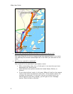
• Create a route by adding start and finish points on your map. Customize your
route by adding stops and vias.
• Connect your GPS device to the program and track your progress on a
portable computer as you travel. View your next turn as well as the turn after
that—very helpful when you need to make a turn directly after another turn.
You can even use the automatic back-on-track feature to recalculate your
route when detours veer you off course.
• Issue voice commands and receive spoken directions.
• Export a map to a handheld device.
• Create custom keyboard shortcuts or select a DeLorme shortcut scheme, such
as 3-D Navigation, to navigate the program more easily than ever.
• Use the toolbar to share maps, open/create/save projects, start/stop GPS,
edit your preferences, and more.
• Combine digital photos and data with GPS locations using GeoTagger.


