


XMap User Guide
356
o Aerial Imagery (DOQQ)
— 15-17
Black and white 1-meter resolution digital aerial photography. Downloaded
using the NetLink tab.
o Color Aerial Imagery (DOQQ)
— 13-17
True-color 1-meter resolution digital aerial photography. Downloaded using
the NetLink tab.
o NOAA Nautical Charts
(varies)
Color bathymetric nautical charts produced by the National Oceanic and
Atmospheric Administration (NOAA). Downloaded using the NetLink tab.
o USGS Hi-resolution 133 City Imagery
— 13-17
Color aerial imagery over the country's largest metropolitan areas with a
resolution of approximately 1/3 meter (or about 1 foot).
• For information on how data zoom levels display on Earthmate PN-Series GPS
devices, see Data Zoom Level/Scale Bar Translation.
Creating a Map Package
You can export maps to use on a DeLorme Earthmate® PN-Series device or a
compatible Palm® OS or Pocket PC PDA. You must have Street Atlas USA®
Handheld installed to view exported maps on a PDA.
See the Creating Maps for an Earthmate PN-Series GPS tutorial in the application’s
Help for more information.
To Create a Map Package
Use the following steps to create a custom map to send to an Earthmate PN-Series
GPS or PDA.
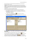
1. Set your handheld export preferences using the Handheld tab in the Options
dialog box. Be sure to specify if you are exporting maps to a DeLorme
Earthmate or Palm OS/Pocket PC device.
2. Click the Handheld Export tab.
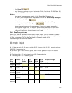
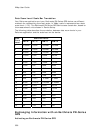
3. To manually select the export area, choose an appropriate grid size from the
Grid Size drop-down list (see Grid Size Comparisons for more information),
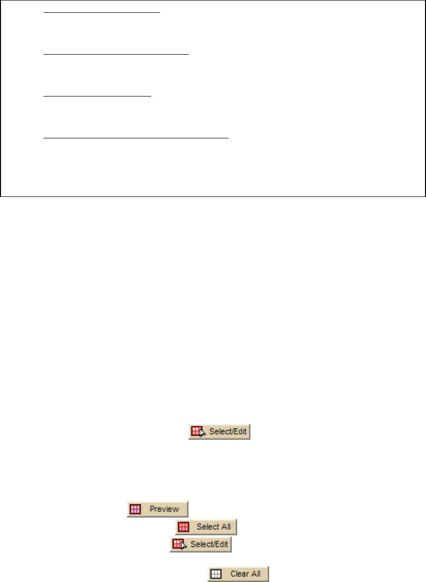
click the Select/Edit button
, and click grids on the map to add
or remove them. Grids selected for export are shaded red.
OR
Select the grid size from the Grid Size drop-down list (see Grid Size
Comparisons for more information), type a location in the Search for and
select a location box, click a result in the results list, and then click the
Preview button
. The default export area is defined with shaded
grids. Click the Select All
button to select the default export area
or click the Select/Edit
button to add or remove grids. Grids
selected for export are shaded red.
Note Click the Clear All button
to clear the highlighted grids
from the map.
4. Type a name for your map package in the Save your map for Exchange
box.