


Getting Started
25
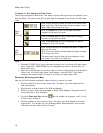
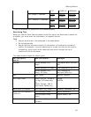
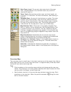
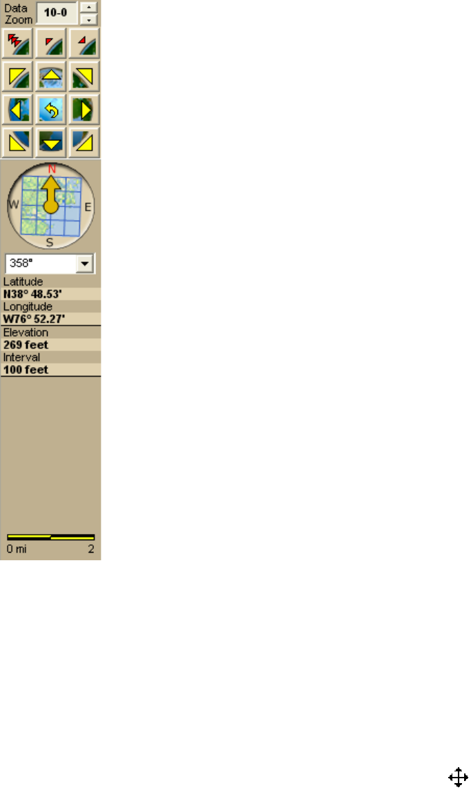
Data Zoom Level—The current data zoom level of the map
view; ranges between 0-0 (maximum zoom out) and 20-0
(maximum zoom in).
Zoom Tools—Buttons that quickly zoom out three levels, out
one level, or in one level. For more information, see Zooming In
and Out.
Compass Rose—A group of nine buttons on a globe. The outer
buttons have yellow arrows; click one of the arrow buttons to
pan the map in that direction. Click the middle button to center
the map on the previous map view. This button performs an
undo function for the last pan or zoom (up to 256 times).
Map Rotation Tool—The arrow in the graphic indicates True
North in relation to the rotated map. Use the Map Rotation Tool
to rotate the map in any direction. You can rotate the map by
clicking or dragging the square map graphic in the direction you
want or by selecting/typing the degree of map rotation from the
drop-down list.
Map Coordinates—Coordinates for the current map cursor
position display based on the units of measurement preferences
chosen in the Display tab of the Options dialog box.
Elevation and Interval—Display in the measurement chosen in
the Display tab of the Options dialog box. The data zoom level
affects interval display.
Scale Bar—Indicates the distance one scale bar unit equals in
the measurement chosen under in the Display tab of the Options
dialog box.
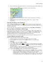
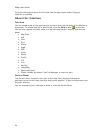
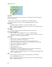
Overview Map
The overview map is a small map in the lower-right corner of the screen that offers a
wide-angle view of your current map view area. It is approximately three data zoom-
levels out from the current map view.
Tips
• Click anywhere on the overview map and that point becomes the new map
center. This allows you to travel greater distances with each mouse click than
you can within the larger, current map view.
• Use the black view box in the overview map window to pan the map. Point
anywhere on the view box. When the pointer becomes a
, drag the view
box to the new location.