


XMap User Guide
360
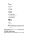
See the following topics for information about exchanging information with an
Earthmate PN-Series GPS.
Earthmate PN-40
Sending/Receiving Maps
Sending/Receiving Routes
Sending/Receiving Tracks
Sending/Receiving Waypoints
Firmware Updates
Earthmate PN-20
Sending/Receiving Maps
Sending/Receiving Routes
Sending/Receiving Tracks
Sending/Receiving Waypoints
Firmware Updates
Adding Draw Layers to a Map Package
If you have draw layers (excluding waypoints and tracks) that you want to send to
an Earthmate® PN-40, you can use the Handheld tab in the Options dialog to create
a map that includes the data. You can then use the Exchange dialog to send the map
to the device.
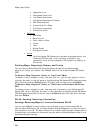
To Create a Map with Draw Layers
Use the following steps to create a map with draw layers to send to the device:
1. Click the Draw tab.
2. Select each draw layer you want to send to the device.
Selected layers appear on the map.
3. Click the Handheld Export tab and zoom to the area of interest on the map.
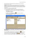
4. Click the Options button to open the Handheld tab in the Options dialog box.
5. Under Export Map Format and Location, select DeLorme Earthmate.
Note Map packages are saved in the location displayed. To change where
you save map packages, click Browse and navigate to the new location.
6. Under Export Map Source, select the map with the draw layer (Left or
Right).
7. Under Export Data Zooms, select Draw Layers.
8. Choose the zoom ranges at which you want to view the data at on the
handheld device.
9. Select Less Detail or Full Detail. Full Detail saves the data as it appears on
the map, but the file size is larger. Less Detail reduces the detail on the map
so the file size is smaller.
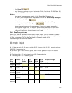
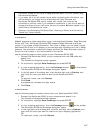
10. Click Select/Edit
to select the grids that cover the draw layers
you want to send to the device.
You can use the Grid Size control to modify the grid size. When selecting
grids, you will receive an error in the Info box if the map output is too large.
You can select fewer grids or adjust the Draw Layers zoom ranges to reduce
the map output size.
To Send Draw Layers