


XMap User Guide
130
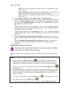
3. Select the check box next to each layer you want to make visible in the
legend.
Note To select multiple layers, hold the CTRL or SHIFT keys on your
keyboard while you click each of the layers you want to include in the legend.
Then, click the Layers button and click Check Selected.
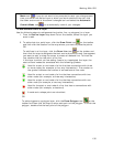
4. Click Tools and then click Legend to view the legend information.
OR
Right-click the layer(s) for which you want to view legend information and
click Legend.
5. Click the Close button
in the upper-right corner of the legend to close the
Legend window.
Deleting a Layer
This Help topic describes features that are available in XMap
Professional, XMap GIS Editor, and XMap GIS Enterprise.
When you delete a layer, it is permanently removed from the database.
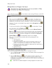
To Delete a Layer
Use the following steps to delete a layer in a database.
1. Click the GIS tab.
2. Click the Workspace subtab if it is not selected.
3. In the Workspace list, click the layer you want to delete. To highlight
multiple layers for deletion, hold the CTRL or SHIFT keys on your keyboard
while you click each layer you want to delete.
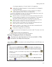
4. Right-click the layer(s) in the list and click Delete.
A confirmation message displays.
OR
Click the Layers button and then click Delete.
A confirmation message displays.
5. Click Yes to delete the layer(s) from the database.
Note You can also delete layers from a database using the Manage Layers dialog
box. Click the Manage Layers tool
on the toolbar; under Layers in the
Database, click the layers you want to delete; and then click the Delete button
.
Exporting a Layer
This Help topic describes features that are available in XMap
GIS Editor and XMap GIS Enterprise.
Once you edit your layer, you may want to export the layer to another program that
supports shapefiles, GML files, text files (point layers in XMap 5.0 GIS Enterprise and
later only), or DeLorme OpenSpace transfer files (XMap 4.5 and later).
DeLorme OpenSpace transfer files contain all of your GIS data, including
classification, symbolization, attributes, query information, etc. (shapefiles and GML
files do not). If you have an active query against the layer you are exporting, you