


XMap User Guide
288
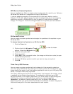
• Limit which records of the dataset display in the table by selecting one
of the options from the Table Display drop-down list. Some of the
Table Display options provide additional drop-down lists to choose a
more limited query. For example, selecting the Records by Placement
option provides an additional drop-down list of options so you can
choose to display only those records placed to specific addresses, only
those records placed manually, and so on.
Additional Viewing Tips
The following list provides information on how to view records or obtain information
about the dataset symbols on the map while in the Query dialog area.
• To select records and view the corresponding symbol on the map:
To select one record, click the record.
To select multiple records individually, press the CTRL key on your
keyboard while clicking each of the individual records.
To select a block of records, press the SHIFT key while clicking the
record at the beginning of the block, and then click the record at the
end of the block. All of the records are selected.
• To center the map on the selected record(s), click Go To.
Note To geoplace records again, click GeoCode.
• To delete one or more records within the dataset, while in the Query dialog
area, select each record using one of the methods described above and then
click Delete. Click Yes to confirm the deletion. Deleted records are
unrecoverable.
• To view the record of a particular dataset symbol on the map, click Select
and then click the symbol on the map. Only the corresponding records display
in the record window.
• To resize columns, place the pointer near the column border in the header of
the desired column. When the pointer changes to a double arrow, drag the
column in the direction you want to increase or decrease its size.
• To arrange the records in ascending order according to a particular column,
click the header of that column. Click the column header again to arrange the
records in descending order.
Creating a Route with XData Records
• The XData tab is hidden by default. Use Tab Manager to show
the XData tab.
• Routable roads require a routable DeLorme dataset. Routable
trails require a topographic DeLorme dataset. For information,
visit www.delorme.com or call DeLorme Direct Sales at 800-
561-5105.
Once you import an XData dataset, you can use the individual records within the
dataset to create a route.
To Create a Route with XData Records
Use the following steps to create a route with XData records.