


XMap User Guide
198
5. Select the check box to the left of the Scale Bar style options and then select
the Scale Bar style.
AND/OR
Select the Scale check box to display the current scale on the map.
AND/OR
Select the Scale Reference Length check box to display the scale reference
length on the map.
AND/OR
Select the Zoom check box to display the current data zoom level on the
map.
6. Click the location on the map where you want to add the graphic.
Once you place the Scale Bar on the map, you can resize it by dragging any
of the white boxes on the corners/sides of the graphic.
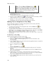
To Add an Image to Your Map
Use the following steps to add an image to your map.
1. Click the Print tab and then click the Map subtab.
2. Select your Map and Print Layout options. For more information, see
Printing a Map.
3. Under Layout Tools, click and hold the text and graphics button to reveal the
hidden text and graphic tools.
4. Click the Image tool
.
5. Click the location on the map where you want to add your image. The Select
Image File dialog box opens.
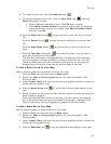
You can reposition the image at any time by dragging it to the new position.
6. Select an image file (.jpg, .bmp, or .gif) to place on your map and then click
Open. The image displays on the map and the file name displays in the text
box next to the Image tool under Layout Tools.
You can update the image at any time by clicking the Browse button
and
browsing to an alternative image.
7. Select the Maintain Aspect Ratio check box to maintain the image's width-
to-height ratio while resizing.
8. Select the Preview Image check box to preview the image on the map.
To Add a GIS Legend to Your Map
Use the following steps to add a GIS legend to your map.
1. Click the GIS tab.
2. Click the Workspace subtab if it is not currently displaying and then select
the check boxes next to each layer for which you want to add the legend to
your map.
3. Click the Print tab and then click Map to view the Print/Map dialog area.
4. Select your Map and Print Layout options. For more information, see
Printing a Map.
5. Under Layout Tools, click and hold the text and graphics button to reveal the
hidden text and graphic tools.
6. Click the GIS Legend tool
.