


XMap User Guide
106
7. Use the notes and annotations in the draw layer to make the appropriate
edits to the corresponding GIS layers to which the user was subscribed.
Stationing
Stationing
This Help topic describes features that are available in XMap
Professional, XMap GIS Editor, and XMap GIS Enterprise.
Stationing is a linear referencing method that calculates numeric values along a line
based on user-defined From and To values. These values are entered into Fr_Station
and To_Station attribute fields for a line in a GIS layer, which are automatically
assigned by XMap to the start and end points of the line.
Stationing is commonly used in the pipeline industry to locate station values
(numeric point locations) along pipelines. For example, field personnel may be given
work orders of sections of pipeline to inspect or repair. These locations may be
referenced by their station values or a range of values along the pipeline. Using a
GIS line layer of the pipeline that has the station values present, the field worker is
able to locate the exact point of the station along the line and navigate to it.
Although stationing has its roots in the pipeline industry, it is a convenient method of
referencing data to a location for any type of linear data.
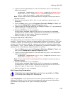
To Add Stationing Attributes to a Layer
Use the following steps to add stationing attributes to a layer.
1. Click the GIS tab.
2. Click the Workspace subtab if it is not selected.
3. View an existing line layer, create a new line layer, or import a line layer.
4. Highlight the layer to which you want to add stationing points.
5. Click the Attributes subtab.
6. If it is not already in Design View mode, click the Design View button
.
7. Add fields "Fr_Station" and "To_Station" to the line layer.
From the Data Type drop-down list, select any numeric type: Integer, Big
Integer, Byte, Double, Float, or Small Integer.
8. Click the Datasheet View
button.
9. Type numeric values in the Fr_Station and To_Station records for the layer.
The Fr_Sation value is automatically assigned to the start point of the line,
and the To_Station is automatically assigned to the end point of the line. The
station value for every location along the line is calculated based on the start
and end point values.