


Working With GIS
163
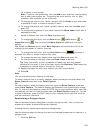
10. To change the minimum and maximum zoom level for a layer, select the
zoom level number from the Min Zoom Level and/or Max Zoom Level
drop-down lists.
11. If you selected Mixed or Login Required in step 5, select the check box in the
Allow Access column for the layers you want to be available by default.
12. Click Apply.
13. Click OK.
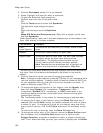
To Manage the Data on Your Site
Use the following steps to manage the data on your site.
1. Click the GIS tab.
2. Click the Workspace subtab if it is not selected.
3. Click the XMap Web button and then click Manage Site.
The Manage Site Settings dialog box opens.
4. Select the site you want to manage from the Select Site drop-down list.
5. Select the desired security for your site from the Site Access drop-down list.
6. Click the Data tab.
7. Select the check box in the Enabled column for each data option you want
users to have access to by default.
8. To change the visibility of the data, select the check box in the Initial
Visibility column for that data option to display by default.
9. Click Apply.
10. Click OK.
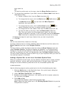
To Manage the Accessibility to Your Site
Use the following steps to manage the accessibility of your site.
1. Click the GIS tab.
2.
Click the Wo
rkspace subtab if it is not selected.
3. Click the XMap Web button and then click Manage Site.
The Manage Site Settings dialog box opens.
4. Select the site you want to manage from the Select Site drop-down list.
5. Select the desired security for your site from the Site Access drop-down list.
6. Click the Users tab.
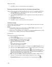
7. If you selected Mixed or Login Required in step 5, select Yes from the
Require User Approval list to require the admin of the site to approve the
use of logging into the site to view secure layers. Select No from the list to
give Mixed and Login Required users immediate access to secure layers.
8. To update a user's access level or status, click to select the user and then
select an option from the applicable drop-down list.
• Admin–An admin controls every part of the XMap Web site, from
updating user information to determining which layers on the site can
be downloaded. There can be only one admin per site.
• User–A user can view layers on that site that the site's admin has
selected to be visible by default.
• Granted–A user or admin has full access.
• Pending–A user has access to the site, but has not registered yet.
• Denied–A user does not have access to the site.