


XMap User Guide
20
map.
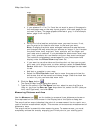
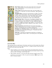
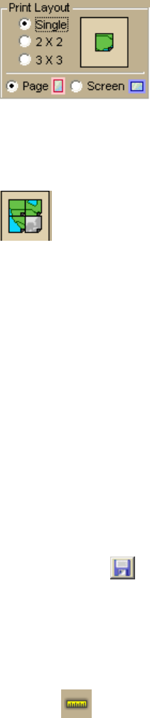
• If you selected 2 x 2 or 3 x 3 and do not want to save all the pages in
the multipage map on the map layout graphic, click each page you do
not want to save. The page appears dimmed or gray. In the example
below, page 4 will not print.
• Verify this is the location and photo zoom you want to save. If not,
pan the map to the location and zoom to the level you want.
Note Changing the photo zoom enlarges/reduces the map features
and changes the map area that you save as an image. If you increase
the photo zoom level, map text, lines, symbols, etc. are larger and
your map area is reduced. If you decrease the photo zoom level, map
text, lines, symbols, etc. are smaller and your map area is enlarged.
The reduction/enlargement percentages for your photo zoom level
display under the Photo Zoom drop-down list.
• If you want to use other tabs and functions but not lose your current
print area, print photo zoom, or other settings, select the Lock Print
Center check box. This locks the print area and changes the tab label
to red.
• Add text or graphics to your map.
• Select the Print Preview check box to zoom the map and view the
entire area that will be saved as a bitmap image. Clear the check box
to return to your previous data zoom level.
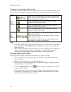
6. Click the Save button
.
The Save 2D Map Image dialog box opens.
7. Type the file name in the File Name text box, select to save the file as a
.bmp or .jpg from the Save as Type drop-down list, select the DPI (dots per
inch) value (optional), and click Save.
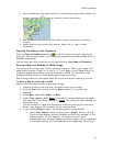
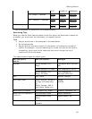
Measuring Distance and Area
Use the Measure tool on the toolbar to measure linear distance and area on
the map based on the units chosen in the Display tab of the Options dialog box.
The snap function snaps (attaches) the point of a measurement line to a point on a
road or another measurement object. This ensures a more accurate measurement of
distance or area.
The snap function is essential when measuring area. To measure area, you must
completely enclose the area by snapping your finish point to your starting point.