


2 - NAV PAGES
35
190-00357-00 Rev E
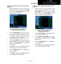
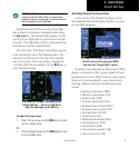
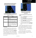
To quickly declutter the map display, press the
CLR key momentarily (as often as needed) to
select the desired amount of map detail.
To quickly declutter the map, press CLR. Continue pressing
CLR to select the desired declutter level. Note the scale is
followed “-1”, “-2” or “-3”.
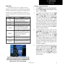
Declutter Level Detail
-1 Removes all land data except rivers
and lakes.
-2 Removes all airspace except Prohibit-
ed and Restricted. Also removes NDBs,
Intersections, and User waypoints.
-3 Removes all data except the Active
Flight Plan, Prohibited airspace ,rivers,
lakes, traffic, and lightning data (also
equivalent to “-A” approach mode
decluttering.
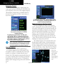
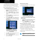
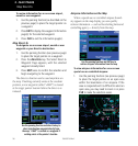
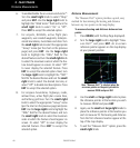
Map Panning
Another Map Page function is panning, which
allows you to move the map beyond its current limits
without adjusting the map scale. When you select
the panning function — by pressing the small right
knob — a target pointer flashes on the map display.
A window also appears at the top of the map display
showing the latitude/longitude position of the pointer,
plus the bearing and distance to the pointer from your
present position.
Panning the map lets you look beyond the
boundaries of the current map area without
changing the scale. Start by pressing the
small right knob.
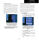
To select the panning function and pan the map
display:
1. Press the small right knob to activate the
panning target pointer.
2. Turn the small right knob to move up (turn
clockwise) or down (turn counterclockwise).
3. Turn the large right knob to move right (turn
clockwise) or left (counterclockwise).
4. To cancel the panning function and return to
your present position, press the small right
knob.
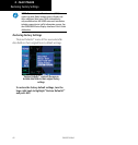
When the target pointer is placed on an object, the
name of that object is highlighted (even if the name
wasn’t originally displayed on the map). This feature
applies to airports, navaids, user-created waypoints,
roads, lakes, rivers — just about everything displayed
on the map except route lines.
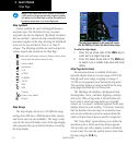
When an airport, navaid, or user waypoint is
selected on the map display, you can review infor-
mation about the waypoint or designate the waypoint
as your direct-to destination.
Map Panning