


9 - AUX PAGES
183
190-00357-00 Rev E
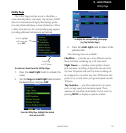
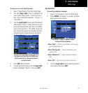
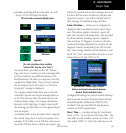
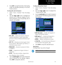
Setup 1 Page
automatic switching will not take place.
SeeAUX
-Setup1forILSCDISelection details.
CDI scales and corresponding flight phases:
En Route
Terminal
Approach
(For each scale/phase to be available,
“Selected CDI” must be set to “Auto”)
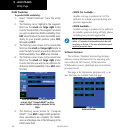
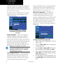
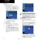
Maximum
Anarrivalalarm,providedontheCDI/Alarms
Page, may be set to notify you with a message when
you have reached a user-defined distance to the
final destination (the direct-to waypoint or the last
waypoint in a flight plan). Once you have reached
the set distance (up to 99.9 units), an “Arrival at
[waypoint]” message is displayed.
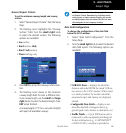
The Airspace Alarms fields allow you to turn the
controlled / special-use airspace message alerts on
or off. This does not affect the alerts listed on the
Nearest Airspace Page or the airspace boundaries
depicted on the Map Page. It simply turns on/off
the warning provided when you are approaching or
near an airspace.
An altitude buffer is also provided which “expands”
the vertical range above or below an airspace. For
example, if the buffer is set at 500 feet, and you are
more than 500 feet above or below an airspace, you
will not be notified with an alert message; if you are
less than 500 feet above or below an airspace and
projected to enter it, you will be notified with an
alert message. The default setting is 200 feet.
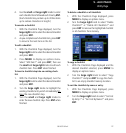
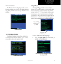
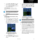
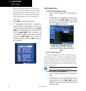
Units / Position — allows you to configure the
displayed data to standard or metric units of mea-
sure. This setting applies to distance, speed, alti-
tude, fuel, pressure and temperature. Also provided
are three variation (heading) options: Magnetic,
True, and User. If “Magnetic” is selected, all track,
course and heading information is corrected to the
magnetic variation computed by the GPS receiver.
The “True” setting references all information to true
north. The “User” selection allows the pilot to enter
values between 0º and 179º E or W.
Use the Units / Position Page to switch
distance and speed measurements between
Nautical, Statute and Metric units.
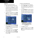
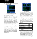
Configuration settings for position format and map
datum are also provided. Position formats include
latitude/longitude, MGRS and UTM/UPS. The
NavData
®
card uses the WGS 84 map datum to
conform to WAAS requirements.
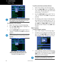
Date / Time — provides settings for time format
(local or UTC; 12- or 24-hour) and time offset. The
time offset is used to define current local time. UTC
(also called “GMT” or “zulu”) date and time are cal-