


14
TAKEOFF TOUR
190-00357-00 Rev E
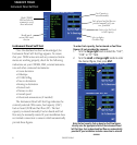
Map Page
Map Page
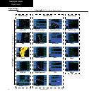
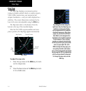
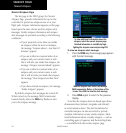
The Map Page displays your present position
(using an airplane symbol) relative to nearby airports,
VORs,NDBs,intersections,userwaypointsand
airspace boundaries — and your route displayed as a
solid line. The current Map Scale is indicated in the
lower left corner and adjustable using the RNG key.
The Map Scale refers to the distance from the
bottom to the top of the viewable display.
After the GNS 530W acquires satellites and com-
putes a position, the Map Page appears automatically.
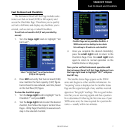
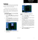
MAP PAGE
Map Display
Map
Scale
Present Position
Desired
Track
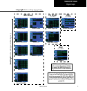
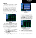
To adjust the map scale:
1. Press the up arrow on the RNG key to zoom
out to a larger area.
OR,
2. Press the down arrow on the RNG key to zoom
in to a smaller area.
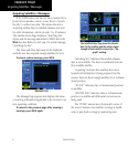
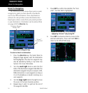
By adding data fields along the
right-hand side, the Map Page can
combine a moving map display
and navigation data for complete
situational awareness. Map setup
pages are provided to add these
data fields and to designate the
maximum scale at which each map
feature appears. These settings
provide an automatic decluttering
of the map (based upon your prefer-
ences) as you adjust the scale.
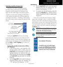
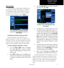
While viewing the map page, you
can quickly declutter and remove
many of the background map details
by pressing the CLR key (repeatedly)
until the desired detail is depicted.
To change the map scale, use the
RNG key.