


10 - VNAV
194
190-00357-00 Rev E
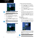
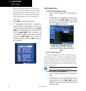
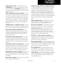
To create a vertical navigation profile:
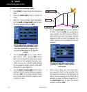
1. Press VNAV to display the Vertical Navigation
Page.
2. Press the small right knob to activate the
cursor.
3. With the “Target Altitude” field highlighted,
turn the small and large right knobs to select
the target altitude and press ENT.
Turn the small and large right knobs to select
a target altitude. The target altitude can be
above field elevation (for an airport) or you
can specify an MSL altitude for any waypoint
category.
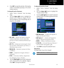
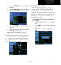
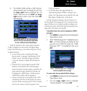
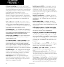
4. Turn the small right knob to select “Above
Wpt” (AGL) or “MSL”, and press ENT. “Above
Wpt” uses the altitude of a destination airport
as stored on the Jeppesen NavData card.
“MSL” lets you set a specific target altitude
for any waypoint category: airport, VOR, NDB,
intersection or user waypoint.
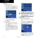
5. Turn the small and large right knobs to select
a distance from the target reference waypoint
and press ENT. If the target altitude should
occur at the target reference waypoint, enter
a distance of zero.
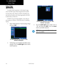
6. Turn the small right knob to select “Before”
or “After”, and press ENT. This setting desig-
nates whether the offset distance defines a
point before you reach the target reference
waypoint or after you reach the waypoint. The
“After” selection is not available for the last
waypoint.
Turn the small right knob to select whether
the distance is “Before” or “After” the refer-
ence waypoint.
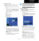
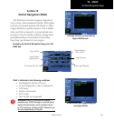
7. When using a flight plan, the target refer-
ence waypoint itself can be specified from
the waypoints contained in the flight plan. By
default, the last waypoint in the flight plan is
selected. To select a different waypoint, turn
the small right knob to select the desired
waypoint and press ENT.
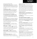
Vertical Navigation Profile