


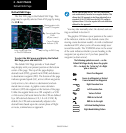
2 - NAV PAGES
30
190-00357-00 Rev E
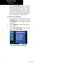
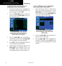
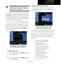
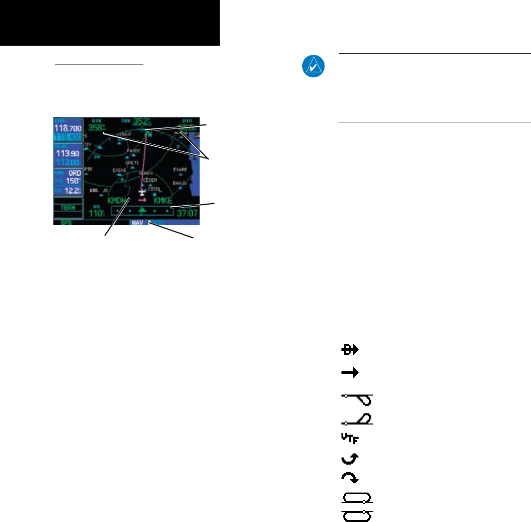
Default NAV Page
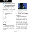
TherstNAVpageistheDefaultNAVPage.This
page may be quickly selected from ANY page by using
the CLR key.
Active Leg of Flight Plan,
or Direct-to Destination
User-selectable Data
Fields
(all four corners)
Course Deviation
Indicator (CDI)
First Page in NAV Group
Bearing pointer to the
current TO waypoint
To select the NAV group and display the Default
NAV Page, press and hold CLR.
ThedefaultNAVPageprovidesa“lookahead”
map display with your present position at the bottom
center of the page. The top of the page displays
desiredtrack(DTK),groundtrack(TRK)anddistance
todestinationwaypoint(DIS).Thebottomofthepage
indicates ground speed (GS), active to/from waypoints
(only active to, for a direct-to destination) and esti-
mated time en route. A graphic course deviation
indicator(CDI)alsoappearsatthebottomofthepage.
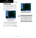
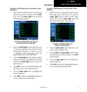
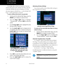
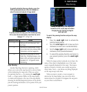
UnliketheangularlimitsonaCDIcoupledtoaVOR
orILSreceiver,fullscalelimitsforthisCDIaredened
by a GPS-derived distance (2.0, 1.0 or 0.3 NM). By
default,theCDIscaleautomaticallyadjuststothe
desired limits based upon the current phase of flight:
en route, terminal area or approach.
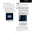
NOTE: Approaching the FAF, the GNS 500W-series
unit automatically rescales in an angular fashion. This
allows the LPV approach to be flown identically to a
standard ILS. At 2.0 NM from the FAF, CDI scaling is
tightened from 1.0 to the angular full scale deflection
defined for the approach.
You may also manually select the desired scale set-
ting as outlined in Section 9.
ThegraphicCDIshowsyourpositionatthecenter
of the indicator, relative to the desired course (the
moving course deviation needle). As with a traditional
mechanicalCDI,whenyou’reoffcoursesimplysteer
toward the needle. The TO/FROM arrow in the center
of the scale indicates whether you are heading to the
waypoint (an up arrow) or if you have passed the
waypoint (a down arrow).
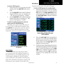
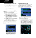
The following symbols are used — on the
Default NAV Page directly above the graphic
CDI — to depict the “active leg” of a flight
plan or direct-to.
Direct-To a Waypoint
Course to a Waypoint, or Desired
Course between Two Waypoints
Right Procedure Turn
Left Procedure Turn
Vectors-To-Final
DME Arc to the left
DME Arc to the right
Left-Hand Holding Pattern
Right-Hand Holding Pattern
Default NAV Page