


9 - AUX PAGES
187
190-00357-00 Rev E
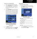
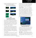
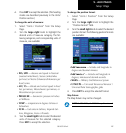
Setup 1 Page
4. Press ENT to accept the selection. (The heading
modes are described previously in the Units/
Position section.)
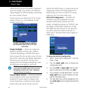
To change the units of measure:
1. Select “Units / Position” from the Setup
Page.
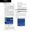
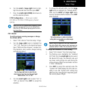
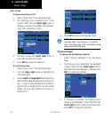
2. Turn the large right knob to highlight the
desired units of measure category. The fol-
lowing categories, and corresponding units of
measure, are available:
•DIS, SPD — distance and speed in Nautical
(nautical miles/knots), Statute (miles/miles
per hour) or Metric (kilometers/kilometers per
hour) terms.
•ALT, VS — altitude and vertical speed in Feet/
feet per minute, Meters/meters per minute, or
Meters/meters per second.
•PRESSURE — barometric pressure in Inches
or Millibars.
•TEMP — temperature in degrees Celsius or
Fahrenheit.
•FUEL — fuel units in Gallons, Imperial Gal-
lons, Kilograms, Liters or Pounds.
3. Turn the small right knob to select the desired
units of measure for the selected category.
Press ENT to accept the selection.
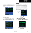
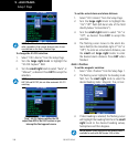
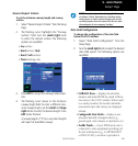
To change the position format:
1. Select “Units / Position” from the Setup
Page.
2. Turn the large right knob to highlight the
“Position Format” field.
3. Turn the small right knob to select the desired
position format. The following position formats
are available:
•hdd°mm.mmm — latitude and longitude in
degrees and decimal minutes
•hdd°mm’ss.s” — latitude and longitude in
degrees, minutes and decimal seconds
•MGRS — Military Grid Reference System
•UTM/UPS — Universal Transverse Mercator /
Universal Polar Stereographic grids
4. Press ENT to accept the selected format.
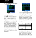
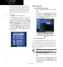
Map Datum:
The Map Datum may not be changed.
NOTE: Per TSO C146a, the WGS-84 map datum is used.