


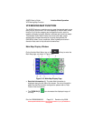
AV8OR User’s Guide Aviation Mode Operation
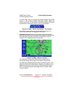
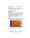
VFR Moving Map Function
Pub. No D200803000008 Page 3-17 Revision July 2008.
© Honeywell International Inc. Do not copy without express permission of
Honeywell.
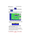
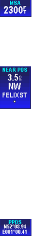
Minimum Safe Altitude Data Field
The minimum safe altitude data window displays the
minimum off-route altitude (from the Jeppesen MORA database.) at
the current aircraft position.
The MSA value is displayed in the currently selected units for altitude.
If the position is invalid then the MSA value is displayed as dashes.
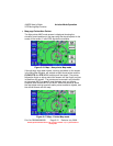
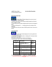
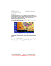
Near Position Data Field
The near position data window displays the current
aircraft position relative to a near-by database feature that is
determined by the user configuration.
If the displayed distance to the nearest selected database feature is
less than 0.1, in the currently selected distance units, then the
position is described as ‘AT’ the database feature.
If the distance is 0.1 or more then the compass bearing from the
database feature is also displayed.
The bearing is one of sixteen compass bearings (e.g. ENE, NE,
SSW).
The icon, used to display the database item on the map, is
displayed immediately below the ident.
The ident is displayed to the maximum width displayable in the
selected data window size.
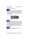
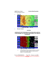
Present Position Data Field
The present position data window displays the
coordinates of the aircraft position in the currently selected
coordinate system.
If the present position is unknown then dashes are displayed.