


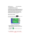

AV8OR User’s Guide Aviation Mode Operation
VFR Moving Map Function
Pub. No D200803000008 Page 3-11 Revision July 2008.
© Honeywell International Inc. Do not copy without express permission of
Honeywell.
of the data window column . The status window also
shows the battery condition and the status of the XM weather
receiver
.
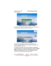
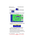
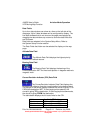
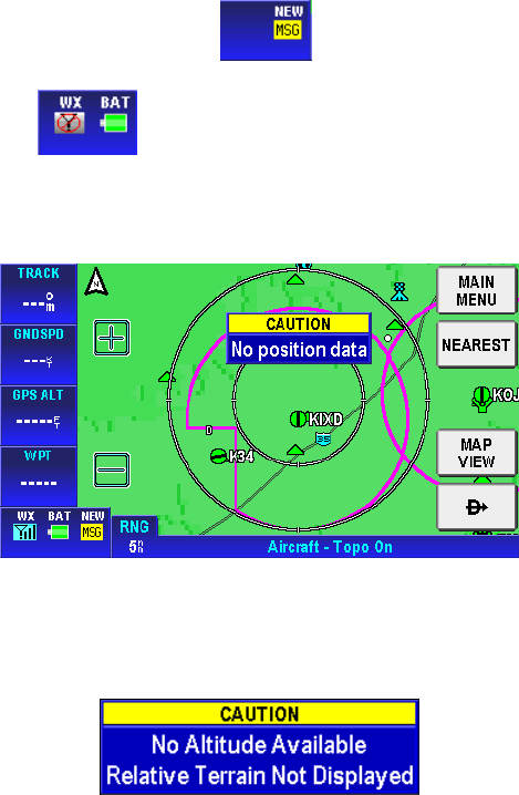
• Caution: When AV8OR has lost its GPS position fix, a blue “No
position data” caution message is displayed across the screen
and the aircraft symbol is not displayed.
Figure 3-14: Map – No position data CAUTION
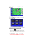
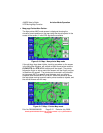
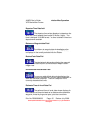
If no altitude data is available and the map display option is set
to Relative Terrain Map, then a “No Altitude Available” message
is displayed.
Figure 3-15: Map – No Altitude Available CAUTION
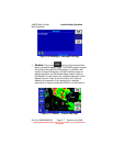
• Image overlays on Map page: The following map image
overlays, if enabled are shown on the map.
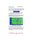
Flight Plan: When there is an active flight plan, the legs and
turning points of the flight plan are shown (Including Direct-To).
Flight Log: Flight log points are plotted when the flight log overlay
has been enabled for the current map scale.