


AV8OR User’s Guide Aviation Mode Operation
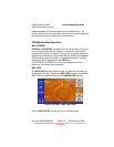
VFR Moving Map Function
Pub. No D200803000008 Page 3-14 Revision July 2008.
© Honeywell International Inc. Do not copy without express permission of
Honeywell.
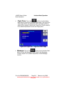
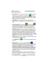
Data Fields
Up to four data windows can show at a time on the left side of the
map page. Up to 9 data windows can be configured for display. The
five data windows that do not show on the page are displayed by
dragging the data windows up or down to show the data fields that
are off screen.
Data fields are selected in the System Setup Menu, Refer to
the System Setup Function section.
The Data Fi
elds that follow can be selected for display on the map
page.
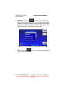
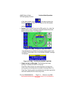
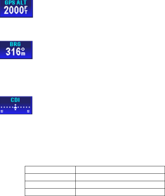
Altitude Data Field
The Altitude Data Field displays the highest priority
enabled GPS altitude source.
Bearing Data Field
The Bearing Data Field displays the bearing of the
current destination WPT for the aircraft position in degrees relative to
magnetic north.
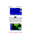
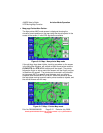
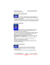
Course Deviation Indicator (CDI) Data Field
The Course Deviation Indicator Data Field displays the
perpendicular distance from the aircraft position to the desired track.
The triangle in the center displays whether the aircraft is going TO or
FROM the destination WPT. If the triangle points upwards, the
aircraft is going TO the destination. If the triangle points downwards,
the aircraft is going FROM the destination.
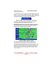
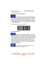
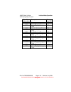
The table below displays the full scale limits for the CDI.
Units Available CDI limits
Nm 0.3Nm, 1.0Nm and 5.0Nm
Statute miles 0.4sm, 1.0sm and 5.0sm
Km 0.6km, 2.0km and 10.0km