1-25
KMD 250 Pilot's Guide
Section 1
Basic Operation
Rev 2 Apr/2004
Press the CLEAR Softkey to return to the map display.
If the FIS INFO Softkey is pressed, the textual METAR page will be
displayed for the closest reporting station to the current selection.
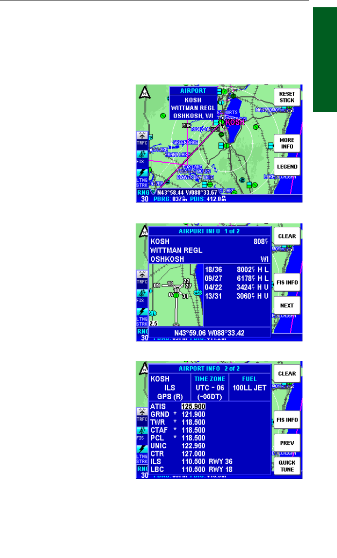
AIRPORT INFORMATION
As shown in Figure 1-31, you
can display airport information
by placing the joystick pointer
over an airport icon. Pressing
the MORE INFO Softkey will
display more detailed runway
information as shown in
Figure 1-32. The RNG Keys
can be used to zoom in or out
on the airport diagram. The
information given here is
derived from the database.
The airport type is shown to
the right of the airport identifier
(KOSH). The airport type is
either MILITARY, PRIVATE
or blank for others (public).
The airport elevation (808ft) is
shown to the right of the air-
port type. Runway orientation
and lengths are displayed to
the right of the airport dia-
gram. Runway surfaces are
shown as an H for hard and
an S for soft. Lighting is
shown as an L for lit and a U
for unlit.
Pressing the NEXT Softkey
will display more details like
radio frequencies and ser-
vices, similar to Figure 1-33.
In the window with the airport
identifier, airport airspace
information and approach
types will be shown. The next
window to the right shows the
difference between UTC and
local standard and daylight
times. The next window will display the available fuel types at this air-
port. See Figure 1-35 for details regarding these fields.
Figure 1-31
Figure 1-33
Figure 1-32
Map Operation


