


2-16
KMD 250 Pilot's Guide
Section 2
FIS Operation
Value Added Service Weather Products
Rev 4 Aug/2007
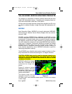
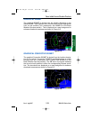
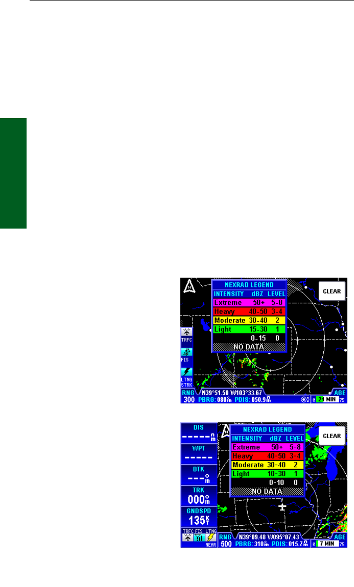
5. The resolution of NEXRAD XM data is 2 km. Thus, when zoomed in
on the display, each square block is 2 km on a side. The intensity level
reflected by the square will be the highest level sampled within the 2 km
area.
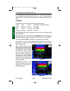
INTENSITY
Precipitation intensity is depicted using colors as follows:
Green Light Level 1 15-30 dBz (10-30 dBz for XM)
Yellow Moderate Level 2 30-40 dBz
Red Heavy Level 3-4 40-50 dBz
Magenta Extreme Level 5-8 50+ dBz
The NEXRAD dBz levels, descriptions and colors are consistent with
FAA guidelines.
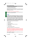
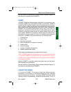
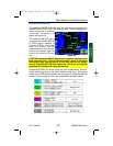
Moving the joystick and pressing the LEGEND Softkey will display the
NEXRAD legend as shown in Figure 2-3 (FIS VDL) and 2-4 (XM WX).
The column labeled dBz is a measure of the radar echo intensity.
The strength of a radar return signal typically varies as a function of
distance (i.e., weaker from distant targets, stronger from those nearby)
and the object size.
Many weather sources avail-
able on the internet use color
coding that is different than
the KMD 250 color coding.
The dBz and intensity level
can be used to compare
intensity levels between dif-
ferent sources of NEXRAD
information since many
internet weather providers will
include a legend with dBz
values indicated.
No Data, as shown in the
legend, indicates the lack of
coverage for reasons dis-
cussed previously.
Figure 2-3
Figure 2-4
KMD 250 FIS_R4 8/13/07 10:07 AM Page 2-16