


1-15
Rev 4 Aug/2007 KMD 250 Pilot's Guide
Section 1
Basic Operation
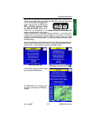
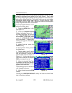
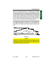
The MSA provides “reference point” clearance within these one degree
latitude by one degree longitude sectors. Jeppesen defines a reference
point as “a natural (Peak, Knoll, Hill, etc.) or man-made (Tower, Stack,
Tank, Building, etc.) object”. Jeppesen states the following about the
Grid Minimum Off-Route altitude: “Grid MORA values clear all reference
points by 1000 feet in areas where the highest reference points are 5000
feet MSL or lower. MORA values clear all reference points by 2000 feet
in areas where the highest reference points are 5001 feet MSL or
higher”. The KMD 250 displays dashes for areas outside the database
coverage area or for areas where the Grid MORA is not defined.
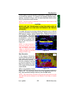
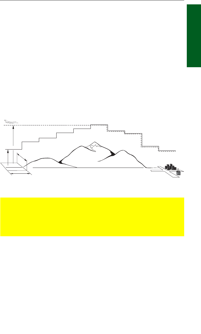
The Enroute Safe Altitude (ESA) is the highest MSA sector altitude from
the present position to the active waypoint, then to the destination way-
point along the active flight plan. See Figure 1-9. When the KMD 250 is
in the OBS Course Mode, the minimum en route safe altitude is the
highest MSA sector altitude from the present position to the active way-
point.
CAUTION
The MSA and ESA altitudes displayed are advisory only. They
should not be relied upon as the sole source of obstacle and ter-
rain avoidance information. Refer to current aeronautical charts for
appropriate minimum clearance altitudes.
Figure 1-9
MSA (MSL)
ESA (MSL)
1° LONG.
1°
LAT.
General Information