


2-68
Section 2
FIS Operation
Understanding Weather Reports
KMD 250 Pilot's Guide
Rev 4 Aug/2007
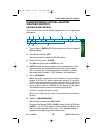
PK WND denotes peak wind.
200 indicates wind direction from 200°.
30/15 indicates a maximum instantaneous wind of 30 knots occurred
at 15 minutes past the hour.
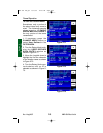
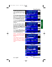
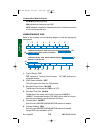
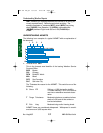
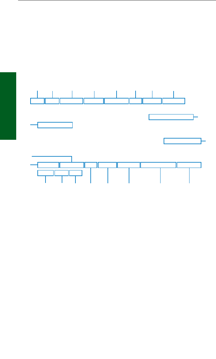
UNDERSTANDING TAFS
Refer to the numbers on the following diagram to find the appropriate
descriptions.
1. Type of Report: TAF
TAF indicates a Terminal Area Forecast. TAF AMD indicates an
amended forecast.
2. ICAO Station Identifier: KPIT
This is the airport for which the TAF pertains.
3. Date and Time of Issue: 091730Z
The 9th day of the month at 1730Zulu or UTC.
4. Date and Time Valid: 091818
The 9th day of the month, valid for 24 hours from 091800Z to
101800Z. An amended forecast (TAF AMD) will be valid for only the
time interval remaining, usually less than 24 hours.
5. Forecast Wind: 22020KT
See #5 in the UNDERSTANDING METARs section for details.
6. Forecast Visibility: 3SM
See #6 in the UNDERSTANDING METARs section for details,
except RVR is not included in a TAF
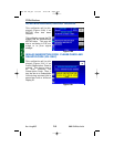
TAF KPIT 091730Z 091818 22020KT 3SM -SHRA BKN020
FM2030 30015G25KT 3SM SHRA OVC015 WS015/30045KT
TEMPO 2022 1/2SM TSRA OVC008CB
FM0100 27008KT 5SM -SHRA BKN020 OVC040 PROB40 0407
00000KT 1SM -RA BR
FM1000 22010KT 5SM -SHRA OVC020 BECMG 1315 20010KT
P6SM NSW SKC
13
4
5
2
6
7
8
9
10
11
1514131216 17 18
19
20
21
KMD 250 FIS_R4 8/13/07 10:07 AM Page 2-68