


1-19
KMD 250 Pilot's Guide
Section 1
Basic Operation
Rev 2 Apr/2004
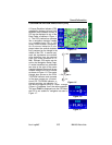
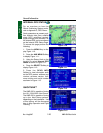
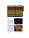
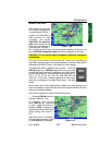
IFR MAP
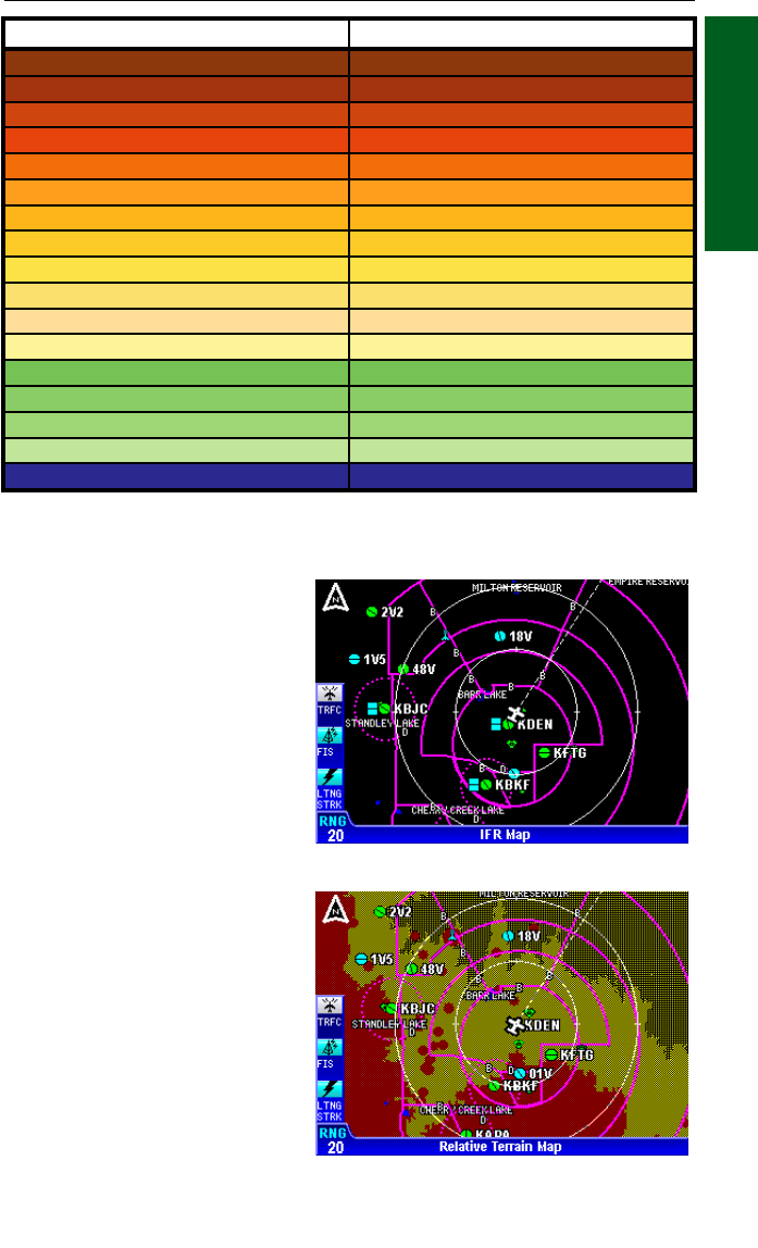
Terrain is not displayed on the
IFR Map display as shown in
Figure 1-16. In addition, all
built up or urban areas are
shaded light gray. Oceans,
rivers and lakes are blue.
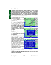
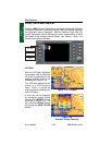
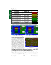
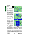
RELATIVE TERRAIN MAP
With Relative Terrain Map dis-
played, topographic data and
obstructions are displayed as
colors corresponding to eleva-
tion relative to the aircraft’s
present altitude as shown in
Figure 1-17. This feature is
useful in providing awareness
to possible terrain hazards at
the present aircraft altitude.
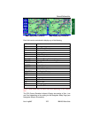
Table 1-2 shows the levels and
terrain shading used on the
Relative Terrain Map.
Figure 1-16 - IFR Map
Figure 1-17 - Relative Terrain Map
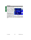
Absolute Terrain Altitude (feet) Color
13000+ Dark Brown
11500-12999
⇓
10000-11499
⇓
9000-9999
⇓
8000-8999
⇓
7000-7999 Light Brown
6000-6999 Dark Tan
5000-5999
⇓
4000-4999
⇓
3000-3999
⇓
2500-2999
⇓
2000-2499 Light Tan
1500-1999 Dark Green
1000-1499
⇓
500-999
⇓
<499 Light Green
Water Blue
Table 1-1 Absolute Terrain (VFR Map)
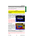
Map Operation