


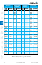
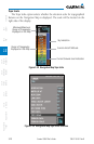

3-16
Garmin G500 Pilot’s Guide
190-01102-02 Rev. B
Foreword
Sec 1
System
Sec 2
PFD
Sec 3
MFD
Sec 4
Hazard
Avoidance
Sec 5
Additional
Features
Sec 6
Annun.
& Alerts
Sec 7
Symbols
Sec 8
GlossaryAppendix A
Appendix B
Index
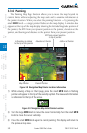
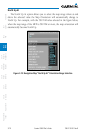
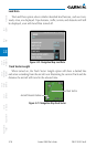
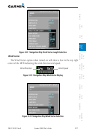
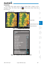
Land Data
The Land Data option selects whether detailed land features, such as rivers,
roads, cities, are displayed. Topo features, traffic, terrain, and obstacles will still
be displayed, even with Land Data turned off.
Figure 3-20 Navigation Map Land Data
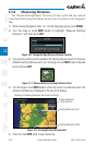
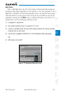
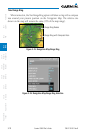
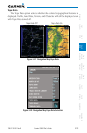
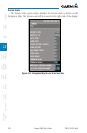
Track Vector Length
When turned on, the Track Vector Length option will show a dashed line
and arrow extending from the aircraft icon illustrating the current Track and the
distance the aircraft will travel in the selected time.
Track Vector
Aircraft Present Position
Figure 3-21 Navigation Map Track Vector