


4-73190-01102-02 Rev. B
Garmin G500 Pilot’s Guide
Foreword
Sec 1
System
Sec 2
PFD
Sec 3
MFD
Sec 4
Hazard
Avoidance
Sec 5
Additional
Features
Sec 6
Annun.
& Alerts
Sec 7
Symbols
Sec 8
Glossary Appendix A
Appendix B
Index
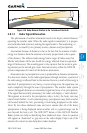
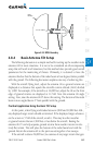
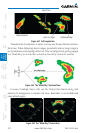
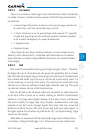
4.8.5.3 Tornadoes
There is no conclusive radar target return characteristics which will identify
a tornado, however, tornadoes may be present if the following characteristics
are observed:
• A narrow, finger-like portion, as shown on the previous page, extends and,
in a short time, curls into a hook and closes on itself.
• A “hook” which may be in the general shape of the numeral “6,” especially
if bright and projecting from the southwest quadrant (northeast quadrant
in the southern hemisphere) of a major thunderstorm.
• V- shaped notches.
• Doughnut shapes.
These shapes do not always indicate tornadoes, nor are tornado returns
limited to these characteristics. Confirmed radar observations of tornadoes
most often have not shown shapes different from those of a normal thunder-
storm display.
4.8.5.4 Hail
Hail results from updrafts carrying water high enough to freeze. Therefore,
the higher the top of a thunderstorm, the greater the probability that it contains
hail. Vertically scanning the target return can give the radar top of a thunderstorm
that contains hail. Radar top is the top of a storm cell
as detected by radar
. It is
not the actual top, or true top of the storm. The actual top of a storm cell is seen
with the eyes in clear air and may be much higher than the radar top. The actual
top does not indicate the top of the hazardous area.
Hail can fall below the minimum reflectivity threshold for radar detection.
It can have a film of water on its surface, making its reflective characteristics
similar to a very large water droplet. Because of this film of water, and because
hail stones usually are larger than water droplets, thunderstorms with large
amounts of wet hail return stronger signals than those with rain. Some hail
shafts are extremely narrow (100 yards or less) and make poor radar targets. In
the upper regions of a cell where ice particles are “dry” (no liquid coating), target
returns are less intense.
Hail shafts are associated with the same radar target return characteristics
as tornados. U-shaped cloud edges 3 to 7 miles across can also indicate hail.