


4-42
Garmin G500 Pilot’s Guide
190-01102-02 Rev. B
Foreword
Sec 1
System
Sec 2
PFD
Sec 3
MFD
Sec 4
Hazard
Avoidance
Sec 5
Additional
Features
Sec 6
Annun.
& Alerts
Sec 7
Symbols
Sec 8
GlossaryAppendix A
Appendix B
Index
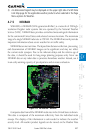
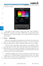
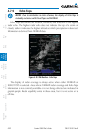
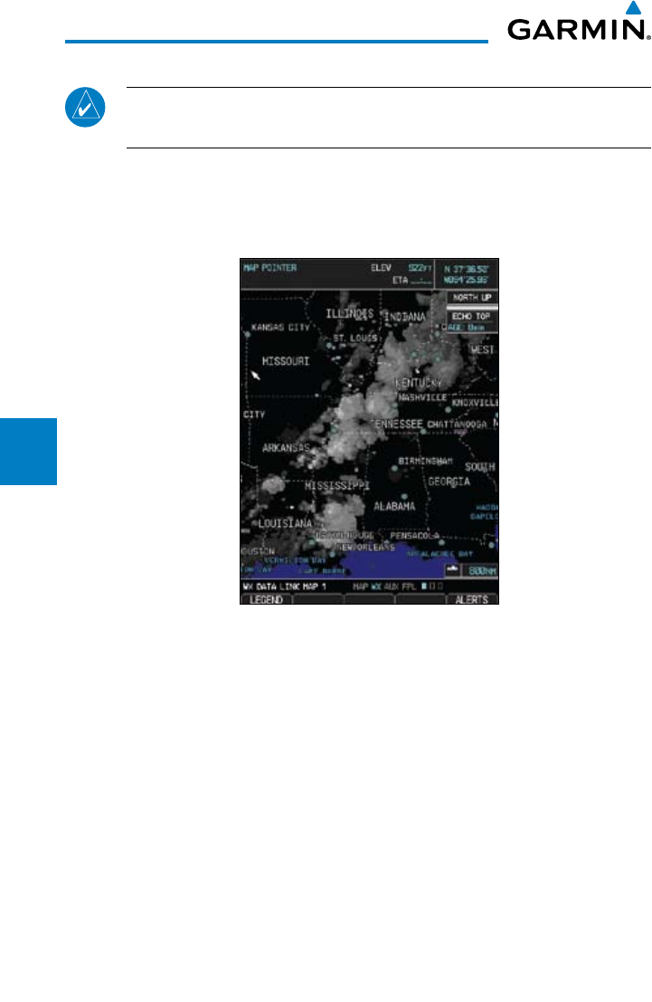
4.7.9 Echo Tops
NOTE: Due to similarities in color schemes, the display of Echo Tops is
mutually exclusive with Cloud Tops and NEXRAD.
Echo Tops data shows the location, elevation, and direction of the highest
radar echo. The highest radar echo does not indicate the top of a storm or
clouds; rather it indicates the highest altitude at which precipitation is detected.
Information is derived from NEXRAD data.
Figure 4-28 XM Weather - Echo Tops
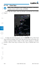
The display of radar coverage is always active when either NEXRAD or
ECHO TOPS is selected. Areas where NEXRAD radar coverage and Echo Tops
information is not currently available or is not being collected are indicated in
grayish-purple. Radar capability exists in these areas, but it is not active or is
off-line.