


5-13190-01102-02 Rev. B
Garmin G500 Pilot’s Guide
Foreword
Sec 1
System
Sec 2
PFD
Sec 3
MFD
Sec 4
Hazard
Avoidance
Sec 5
Additional
Features
Sec 6
Annun.
& Alerts
Sec 7
Symbols
Sec 8
Glossary Appendix A
Appendix B
Index
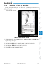
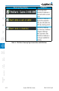
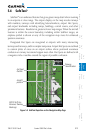
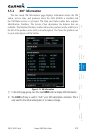
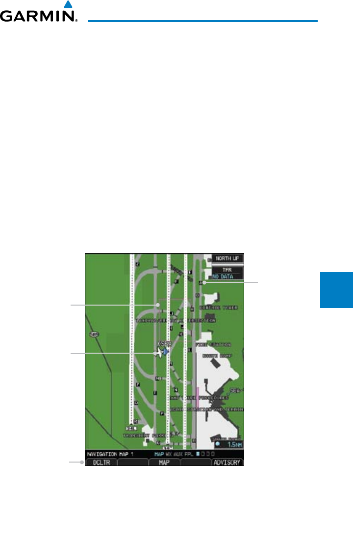
5.4 SafeTaxi
®
SafeTaxi
®
is an enhanced feature that gives greater map detail when zooming
in on airports at close range. The airport display on the map reveals runways
with numbers, taxiways with identifying letters/numbers,
airport Hot Spots,
and airport landmarks including ramps, buildings, control towers, and other
prominent features. Resolution is greater at lower map ranges. When the aircraft
location is within the screen boundary, including within SafeTaxi ranges, an
airplane symbol is shown on any of the navigation map views for enhanced
position awareness.
Designated Hot Spots are recognized at airports with many intersecting
taxiways and runways, and/or complex ramp areas. Airport Hot Spots are outlined
to caution pilots of areas on an airport surface where positional awareness
confusion or runway incursions happen most often. Hot Spots are defined with
a magenta circle or outline around the region of possible confusion.
Taxiway
Identification
Aircraft
position
DCLTR Soft Key
Removes Taxiway
Markings
Hot Spot
Outline
Figure 5-9 SafeTaxi Depiction on the Navigation Map Page