


3-58
Garmin G500 Pilot’s Guide
190-01102-02 Rev. B
Foreword
Sec 1
System
Sec 2
PFD
Sec 3
MFD
Sec 4
Hazard
Avoidance
Sec 5
Additional
Features
Sec 6
Annun.
& Alerts
Sec 7
Symbols
Sec 8
GlossaryAppendix A
Appendix B
Index
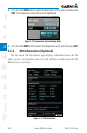
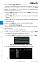
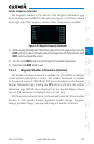
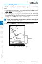
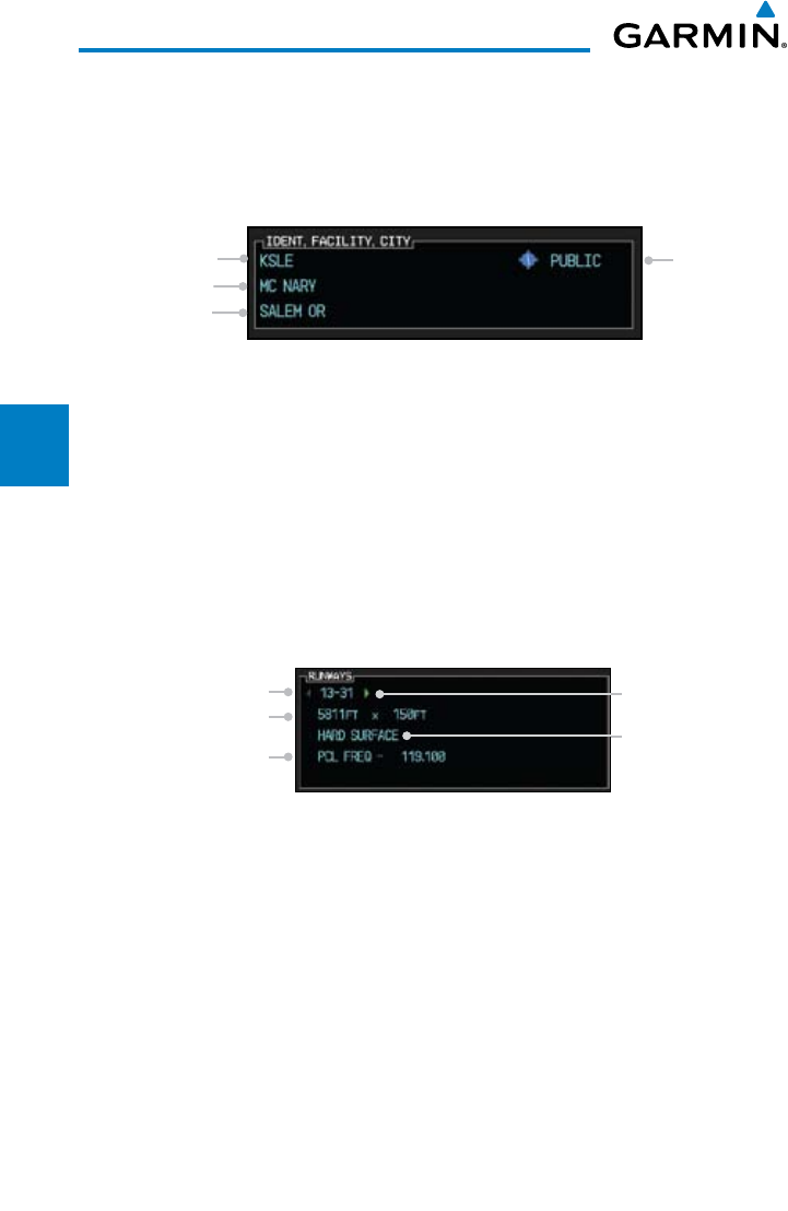
Ident/Facility/City Selection
The current destination Identifier, Facility Type with icon, Facility Name, and
City (location) are shown in the top window of the Flight Plan mode Waypoint
Information page. The default is the Nearest airport if there is no active flight plan.
New Identifiers may also be selected as shown in section 3.5.3.3.
City
Facility Name
Identifier
Access (Public/
Private and
Symbol)
Figure 3-87 Flight Plan Ident/Facility/City Detail
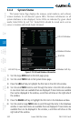
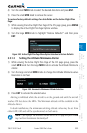
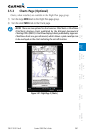
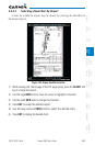
1) While viewing the Waypoint Information page of the FPL page group, press
the INFO soft key to view Runway and Frequency information about the
waypoint.
2) Press the INFO
soft key again to return to the Map view.
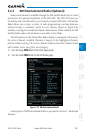
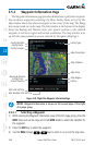
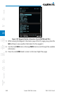
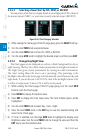
Runway Information Selection
Information is provided for each runway showing the following detail: runway
number, runway length, surface type, and the frequency for Pilot-Controlled
Lighting (PCL).
Runway Number
Runway Surface
Arrow Indicates
More Runways
Runway Length
& Width
Pilot-Controlled
Lighting Frequency
Figure 3-88 Waypoint Runway Information
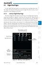
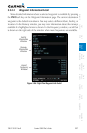
1) While viewing the Waypoint Information page of the FPL page group, press
the INFO soft key to view information about the waypoint and press the small
MFD knob to activate the cursor.
2) Use the large MFD knob to highlight the Runway and use the small MFD knob
to display the available runways.
3) Press the small MFD knob to cancel editing.