


ii
Garmin G500 Pilot’s Guide
190-01102-02 Rev. B
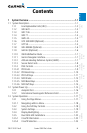
Foreword
Sec 1
System
Sec 2
PFD
Sec 3
MFD
Sec 4
Hazard
Avoidance
Sec 5
Additional
Features
Sec 6
Annun.
& Alerts
Sec 7
Symbols
Sec 8
GlossaryAppendix A
Appendix B
Index
WARNING: Navigation and terrain separation must NOT be predicated
upon the use of the terrain function. The G500 Terrain Proximity feature
is NOT intended to be used as a primary reference for terrain avoidance
and does not relieve the pilot from the responsibility of being aware of
surroundings during flight. The Terrain Proximity feature is only to be used
as an aid for terrain avoidance and is not certified for use in applications
requiring a certified terrain awareness system. Terrain data is obtained
from third party sources. Garmin is not able to independently verify the
accuracy of the terrain data.
WARNING: The displayed minimum safe altitudes (MSAs) are only advisory
in nature and should not be relied upon as the sole source of obstacle and
terrain avoidance information. Always refer to current aeronautical charts
for appropriate minimum clearance altitudes.
WARNING: The Garmin G500 has a very high degree of functional integrity.
However, the pilot must recognize that providing monitoring and/or self-
test capability for all conceivable system failures is not practical. Although
unlikely, it may be possible for erroneous operation to occur without a fault
indication shown by the G500. It is thus the responsibility of the pilot to
detect such an occurrence by means of cross-checking with all redundant
or correlated information available in the cockpit.
WARNING: The altitude calculated by GPS receivers is geometric height
above Mean Sea Level and could vary significantly from the altitude
displayed by pressure altimeters, such as the output from the GDC 74A Air
Data Computer, or other altimeters in aircraft. GPS altitude should never
be used for vertical navigation. Always use pressure altitude displayed by
the G500 PFD or other pressure altimeters in aircraft.
WARNING: Do not use outdated database information. Databases used
in the G500 system must be updated regularly in order to ensure that the
information remains current. Pilots using an outdated database do so
entirely at their own risk.
WARNING: Do not use basemap (land and water data) information for
primary navigation. Basemap data is intended only to supplement other
approved navigation data sources and should be considered as an aid to
enhance situational awareness.