


4-60
Garmin G500 Pilot’s Guide
190-01102-02 Rev. B
Foreword
Sec 1
System
Sec 2
PFD
Sec 3
MFD
Sec 4
Hazard
Avoidance
Sec 5
Additional
Features
Sec 6
Annun.
& Alerts
Sec 7
Symbols
Sec 8
GlossaryAppendix A
Appendix B
Index
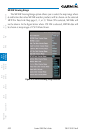
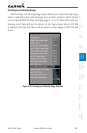
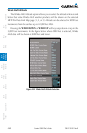
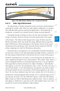
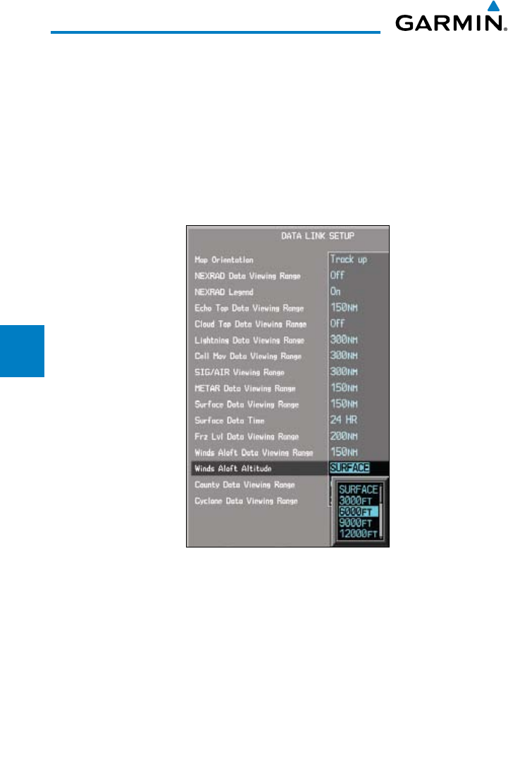
Winds Aloft Altitude
The Winds Aloft Altitude option allows you to select the altitude where at and
below that value Winds Aloft weather products will be shown on the selected
MFD Wx Data Link Map page (1, 2, or 3). Altitude can be selected in 3000 foot
increments from the surface up to 42,000 feet MSL.
Pressing the WIND DOWN or WIND UP soft keys steps down or up in the
3,000 foot increments. In the figure below where 6000 feet is selected, Winds
Aloft data will be shown at 6000 feet and lower.
Figure 4-52 Winds Aloft Altitude Selection