


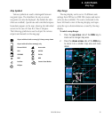

2 - NAV PAGES
41
190-00356-00 Rev E
Terrain Operation
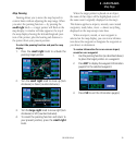
Restoring Factory Settings
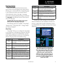
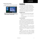
“RestoreDefaults?”resetsallfouruser-selectable
data fields to their original factory default settings.
To restore the factory default settings, press
MENU and turn the large right knob to highlight
“Restore Defaults?”, then press ENT.
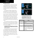
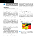
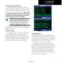
Terrain Operation
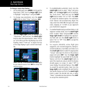
Duringpower-upofthe400WSeriesunit,the
terrain/obstacle database versions are displayed along
with a disclaimer. At the same time, the Terrain system
self-test begins. A failure message is issued if the test fails.
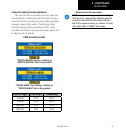
Garmin TERRAIN is a non-TSO-C151b-certified
terrain awareness system provided as a standard feature
of 400W-Series units to increase situational awareness
and help reduce controlled flight into terrain (CFIT).
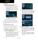
Operating Criteria
TERRAIN requires the following to operate properly:
• Thesystemmusthaveavalid3-DGPSposition
solution.
• Thesystemmusthaveavalidterrain/obstacle/air-
port terrain database.
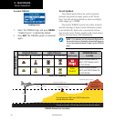
Terrain Limitations
TERRAIN displays terrain and obstructions relative
to the altitude of the aircraft. The displayed alerts are
advisory in nature only. Individual obstructions may be
shown if available in the database. However, all obstruc-
tions may not be available in the database and data may
be inaccurate. Never use this information for navigation
or to maneuver to avoid obstacles.
Terrain information is based on terrain elevation
information in a database that may contain inaccuracies.
Terrain information should be used as an aid to situational
awareness. Never use it for navigation or to maneuver to
avoid terrain.
TERRAIN uses terrain and obstacle information
supplied by government sources. The data undergoes
verification by Garmin to confirm accuracy of the content,
per TSO-C151b. However, the displayed information
should never be understood as being all-inclusive.