


6 - WPT PAGES
121
190-00356-00 Rev E
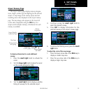
Airport Runway
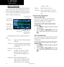
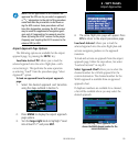
Airport Runway Page
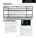
The airport runway page displays runway designa-
tions, length, surface type and lighting for the selected
airport. A map image of the runway layout and sur-
rounding area is also displayed on the airport runway
page. The map image scale appears in the lower left
corner and is adjustable using the RNG key. For
airports with multiple runways, information for each
runway is available.
Runway
Designations
Airport Identifier,
Symbol and Type
Map Image
Second Page
in WPT group
Runway Surface
and Lighting
Runway Length
and Width
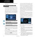
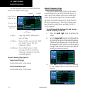
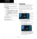
To display information for each additional
runway:
1. Press the small right knob to activate the
cursor.
2. Turn the large right knob to place the cursor
on the runway designation field.
3. Turn the small right knob to display a window
listing all runways for the selected airport.
4. Continue turning the small right knob to
select the desired runway.
5. Press ENT to display information for the
selected runway on the airport runway page.
6. To remove the flashing cursor, press the small
right knob.
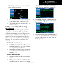
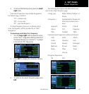
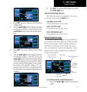
To adjust the scale of the map image:
1. Press the down arrow side of the RNG key to
display a smaller map area.
2. Press the up arrow side of the RNG key to
display a larger map area.