


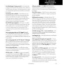
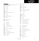

11 - MESSAGES
ABBREVIATIONS &
NAV TERMS
193
190-00356-00 Rev E
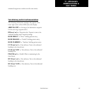
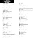
Navigation Terms
The following navigation terms are used on the
400W-series and in this Pilot’s Guide:
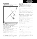
WPT 1
XTK
NORTH
WPT 2
BRG
GS
DIS
AIRPLANE
DTK
TRK
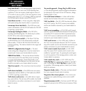
ALT (altitude)— Height above mean sea level (MSL).
BRG (bearing)— The compass direction from your
present position to a destination waypoint.
CAS (calibrated airspeed)— Indicated airspeed cor-
rected for instrument errors.
CUM (cumulative)— The total of all legs in a flight
plan (such as “cumulative distance”).
DIS (distance)— The geodesic path from your pres-
ent position to a destination waypoint.
DTK (desired track)— The desired course between
the active “from” and “to” waypoints.
EFF (efficiency)— A measure of fuel consumption,
expressed in distance per fuel units (e.g., nautical
miles per gallon).
ENDUR (endurance)— Flight endurance, or total
available flight time based upon available fuel.
EPU (estimated position uncertainty)— A measure
of satellite geometry quality and additional factors,
expressed as a horizontal position error in feet or
meters.
ESA (en route safe altitude)— The recommended
minimum altitude within ten miles, left or right, of
your desired course on an active flight plan or direct-
to.
ETA (estimate time of arrival)— The estimated time
at which you will reach your destination waypoint,
based upon current speed and track.
ETE (estimated time en route)— The time it will
take to reach the destination waypoint, from present
position, based upon current ground speed.
FF (fuel flow)— The fuel flow rate, expressed in fuel
units per time (e.g., gallons per hour).
FOB (fuel on board)— The total amount of usable
fuel on board the aircraft.
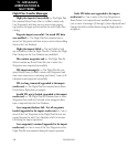
Geodesic — an arc path that follows the shortest dis-
tance along an ellipsoid model of the earth (WGS-84).
A geodesic is more accurate than a “great circle” which
assumes a perfect sphere model of the earch.
GS (ground speed)— The velocity you are travelling
relative to a ground position.
HDG (heading)— The direction an aircraft is
pointed, based upon indications from a magnetic
compass or a properly set directional gyro.
IND (indicated)— Information provided by properly
calibrated and set instrumentation in the aircraft panel
(e.g., “indicated altitude”).