


9 - AUX PAGES
171
190-00356-00 Rev E
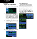
Setup 1
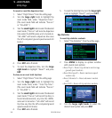
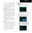
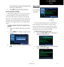
Anarrivalalarm,providedontheCDI/Alarms
Page, may be set to notify you with a message when
you have reached a user-defined distance to the
final destination (the direct-to waypoint or the last
waypoint in a flight plan). Once you have reached
the set distance (up to 99.9 units), an “Arrival at
[waypoint]” message is displayed.
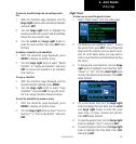
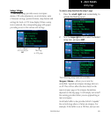
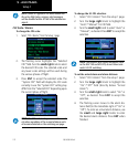
Units / Mag Var— allows you to configure the dis-
played data to standard or metric units of measure.
This setting applies to distance, speed, altitude,
fuel, pressure and temperature and also provides
three variation (heading) options: Magnetic, True,
or User. If “Magnetic” is selected, all track, course
and heading information is corrected to the mag-
netic variation computed by the GPS receiver. The
“True” setting references all information to true
north. The “User” selection allows the pilot to enter
values between 0º and 179º E or W.
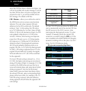
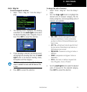
Position / Map Datum— configures position
readout information to the desired position format
andshowstheMapDatum.TheNavData
®
card
uses the WGS 84 map datum to conform to WAAS
requirements.
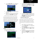
Date / Time— provides settings for time format
(local or UTC; 12- or 24-hour) and time offset. The
time offset is used to define current local time. UTC
(also called “GMT” or “zulu”) date and time are cal-
culated directly from the GPS satellites’ signals and
cannot be changed. If you prefer to use local time,
simply designate the offset by adding or subtracting
the correct number of hours and minutes.
Not all time zones are offset from UTC by a whole
number of hours (e.g., Newfoundland, Central
Australia, India, Iraq, ...).
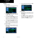
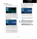
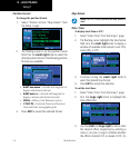
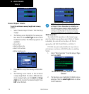
Airspace Alarms
To set the airspace warning messages or change
the altitude buffer:
1. Select “Airspace Alarms” from the setup 1
page.
2. Turn the large right knob to highlight the
“On”/”Off” field next to the desired airspace
type.
3. Turn the small right knob to select “On” or
“Off”, as desired. Press ENT to accept the
selection.
4. To change the altitude buffer, turn the large
right knob to highlight the “Altitude Buffers”
field. Use the small and large right knobs
to enter the desired buffer distance. Press ENT
when finished.