


9 - AUX PAGES
174
190-00356-00 Rev E
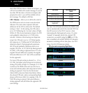
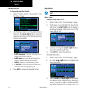
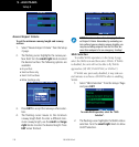
Position Format
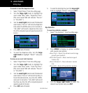
To change the position format:
1. Select “Position Format / Map Datum” from
the Setup 1 page.
2. The flashing cursor is on the position format
field. Turn the small right knob to select the
desired position format. The following position
formats are available:
• hddd°mm.mmm’—latitude and longitude in
degrees and decimal minutes
• hddd°mm’ss.s”—latitude and longitude in
degrees, minutes and decimal seconds
• MGRS—Military Grid Reference System
• UTM/UPS—Universal Transverse Mercator /
Universal Polar Stereographic grids
3. Press ENT to accept the selected format.
Map Datum
NOTE: Per TSO C146a, the WGS-84 map datum is
used.
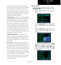
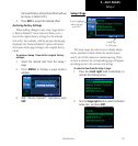
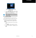
Date / Time
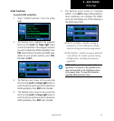
To display local time or UTC:
1. Select “Date / Time” from the Setup 1 page.
2. The flashing cursor highlights the time format
field. Turn the small right knob to display a
window of available time formats: Local 12hr,
Local 24hr, or UTC.
3. Continue turning the small right knob to
select the desired time format.
4. Press ENT to accept the selection.
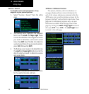
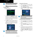
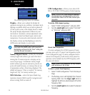
To set the local time:
1. Select “Date / Time” from the Setup 1 page.
2. Turn the large right knob to highlight the
time offset field.
3. Use the small and large right knobs to enter
the desired offset, beginning by entering a
minus (-) or plus (+) sign to indicate whether
the offset is behind UTC or ahead of UTC. (In
Setup 1