


9 - AUX PAGES
163
190-00356-00 Rev E
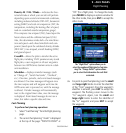
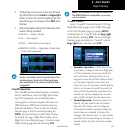
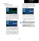
Utility Page
The following items are available:
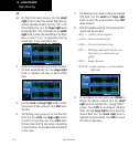
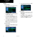
Checklists—
provides up to nine different user-
defined checklists containing up to 30 items each.
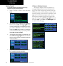
Flight Timers—
provides count up/down timers,
plus automatic recording of departure time and total
triptime.Departureandtotaltriptimerecording
can be configured to run either any time 400W-
series power is on, or only when your ground speed
exceeds 30 knots.
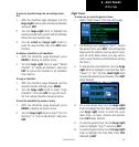
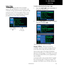
Trip Statistics—
provides readouts for trip odom-
eters, average speed and maximum speed. These
readouts are resettable (individually or all at once)
by pressing MENU to display an options window.
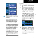
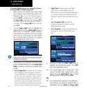
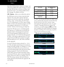
RAIM Prediction—
predicts if GPS cover-
age is available for your current location or at a
specified waypoint at any time and date. Receiver
Autonomous Integrity Monitoring performs checks
to ensure that the 400W-series unit has adequate
satellite geometry during your flight. RAIM avail-
abilityisnear100%inOceanic,EnRouteand
Terminal phases of flight. Because the FAA’s TSO
requirements for non-precision approaches specify
significantly better satellite coverage than other
flight phases, RAIM may not be available when
flying some approaches. The 400W-series unit
automatically monitors RAIM during approach
operations and warns you if RAIM is not available.
Insuchcases,usetheGNS430W’sVLOCreceiver
instead for the approaches. RAIM prediction helps
you plan for a pending flight to confirm GPS opera-
tion during an approach.
RAIM prediction only predicts the availability of
FaultDetection(FD)integrityintheabsenceof
WAAS corrections. It cannot predict the availability
ofLPVapproaches.TheFAAprovidesaNOTAM
serviceforLPVapproachavailability.
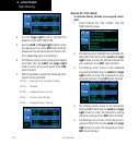
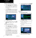
An “INTEG” annunciation at the bottom left corner of the
screen indicates that satellite coverage is insufficient to pass
built-in receiver autonomous integrity monitoring (RAIM)
tests. When this occurs, the GPS receiver will continue to
provide navigation information, but should not be used for
primary navigation guidance. Use the GNS 430W’s VLOC
receiver or another suitable navigation source.
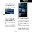
Sunrise / Sunset—
allows you to calculate the time
of sunrise and sunset at any waypoint or your pres-
ent position for a specified date.
Software Versions — provides software ver-
sion information for the operating software within
theGPSreceiver,COMtransceiver,VOR/localizer
receiver, glideslope receiver and main processor
board.
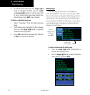
Database Versions —TheDatabaseVersions
Page displays the current Jeppesen database type,
effective date, and expiration date, along with the
version and type of built-in land database.
Terrain Database Versions — The Terrain
DatabaseVersionsPagedisplaysthecurrentterrain
and obstacle database types, version, cycle, effective
date, and expiration date.