


2 - NAV PAGES
35
190-00356-00 Rev E
Map Page
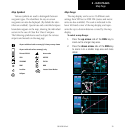
Map Panning
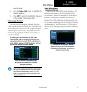
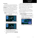
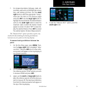
Panning allows you to move the map beyond its
current limits without adjusting the map range. When
you select the panning function — by pressing the
small right knob — a target pointer will flash on the
map display. A window will also appear at the top of
the map display showing the latitude/longitude posi-
tion of the pointer, plus the bearing and distance to
the pointer from your present position.
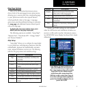
To select the panning function and pan the map
display:
1. Press the small right knob to activate the
panning target pointer.
2. Turn the small right knob to move up (turn
clockwise) or down (counterclockwise).
3. Turn the large right knob to move right (turn
clockwise) or left (counterclockwise).
4. To cancel the panning function and return to
your present position, press the small right
knob.
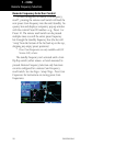
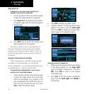
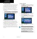
When the target pointer is placed on an object,
the name of that object will be highlighted (even if
the name wasn’t originally displayed on the map).
This feature applies to airports, navaids, user-created
waypoints, roads, lakes, rivers — almost everything
displayed on the map except route lines.
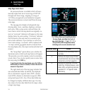
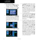
When an airport, navaid, or user waypoint is
selected on the map display, you can review informa-
tion about the waypoint or designate the waypoint as
your direct-to destination.
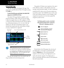
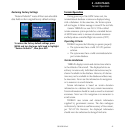
To review information for an on-screen airport,
navaid or user waypoint:
1. Use the panning function (as described above)
to place the target pointer on a waypoint.
2. Press ENT to display the waypoint information
page(s) for the selected waypoint.
3. Press CLR to exit the information page(s).