


190-00595-01 Rev. B
Garmin G1000 Pilot’s Guide for the Beechcraft A36/G36
301
HAZARD AVOIDANCE
SYSTEM
OVERVIEW
FLIGHT
INSTRUMENTS
EIS
AUDIO PANEL
& CNS
FLIGHT
MANAGEMENT
HAZARD
AVOIDANCE
AFCS
ADDITIONAL
FEATURES
APPENDICES INDEX
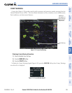
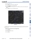
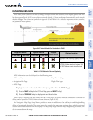
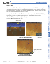
DISPLAYING TAWS DATA
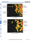
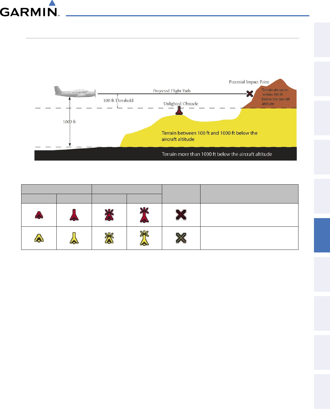
TAWS uses yellow (caution) and red (warning) to depict terrain and obstacles (with heights greater than 200
feet above ground level, AGL) alerts relative to aircraft altitude. Colors are adjusted automatically as the aircraft
altitude changes. The colors and symbols in Figure 6-43 and Table 6-4 are used to represent terrain, obstacles,
and potential impact points.
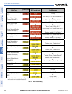
Figure 6-43 Terrain Altitude/Color Correlation for TAWS
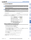
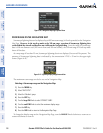
Unlighted Obstacle Lighted Obstacle
Potential
Impact Points
Obstacle Location
< 1000’ AGL > 1000’ AGL < 1000’ AGL > 1000’ AGL
WARNING: Red obstacle is above or within
100’ below current aircraft altitude
CAUTION: Yellow obstacle is between 100’
and 1000’ below current aircraft altitude
Table 6-4 TAWS Obstacle Colors and Symbology
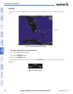
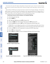
TAWS information can be displayed on the following maps:
• PFD Inset Map
• Navigation Map Page
• TAWS Page
• Trip Planning Page
• Flight Plan Pages
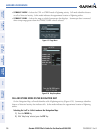
Displaying terrain and obstacle information (maps other than the TAWS Page):
1) Press the MAP Softkey (for the PFD Inset Map, press the INSET Softkey).
2) Press the TERRAIN Softkey to display terrain and obstacle data.
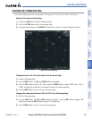
When TAWS is selected on maps other than the TAWS Page, an icon to indicate the feature is enabled for
display and a legend for TAWS terrain colors are shown (Figure 6-50).
The Navigation Map Page Setup Menu provides a means in addition to the softkey for enabling/disabling
display of terrain and obstacles. The setup menu also controls the map range settings above which terrain and
obstacle data are decluttered from the display. If a map range larger than the map range setting is selected, the
data is removed from the map.