


Garmin G1000 Pilot’s Guide for the Beechcraft A36/G36
190-00595-01 Rev. B
292
HAZARD AVOIDANCE
SYSTEM
OVERVIEW
FLIGHT
INSTRUMENTS
EIS
AUDIO PANEL
& CNS
FLIGHT
MANAGEMENT
HAZARD
AVOIDANCE
AFCS
ADDITIONAL
FEATURES
APPENDICESINDEX
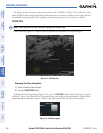
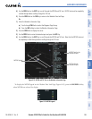
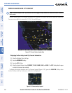
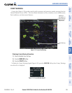
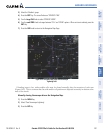
WINDS ALOFT
Winds Aloft data (Figure 6-31) shows the forecasted wind speed and direction at the surface and at selected
altitudes. Altitude can be displayed in 3,000 foot increments up to 42,000 feet MSL.
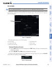
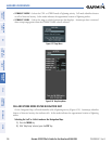
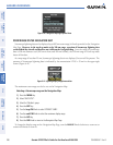
Displaying Winds Aloft data:
1) Select the Weather Data Link Page.
2) Press the
MORE WX
Softkey.
3) Press the
WIND
Softkey.
4) Select the desired altitude level: SFC (surface) up to 42,000 feet. Press the
NEXT
or
PREV
Softkey to cycle
through the altitude softkeys. The
WIND
Softkey label changes to reflect the altitude selected.
Figure 6-31 Winds Aloft Data at 27,000 Feet
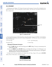
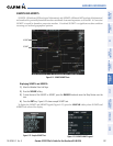
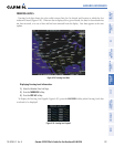
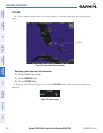
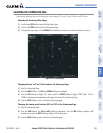
To display the Winds Aloft legend (Figure 6-32), press the
LEGEND Softkey when Winds Aloft is
selected for display.
Figure 6-32 Winds Aloft Data with Legend