


Chapter 5: Standard Chart Operations 5-19
Creating a New Route
• Retrieving a route from the database list as the current route.
• Displaying route information, including the route leg data and waypoint
details. Use the waypoint details to review your passage plans for different
speeds.
• Using the database list to erase and name existing routes.
• Editing a route by adding, removing and moving waypoints.
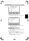
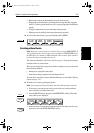
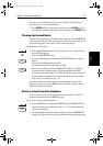
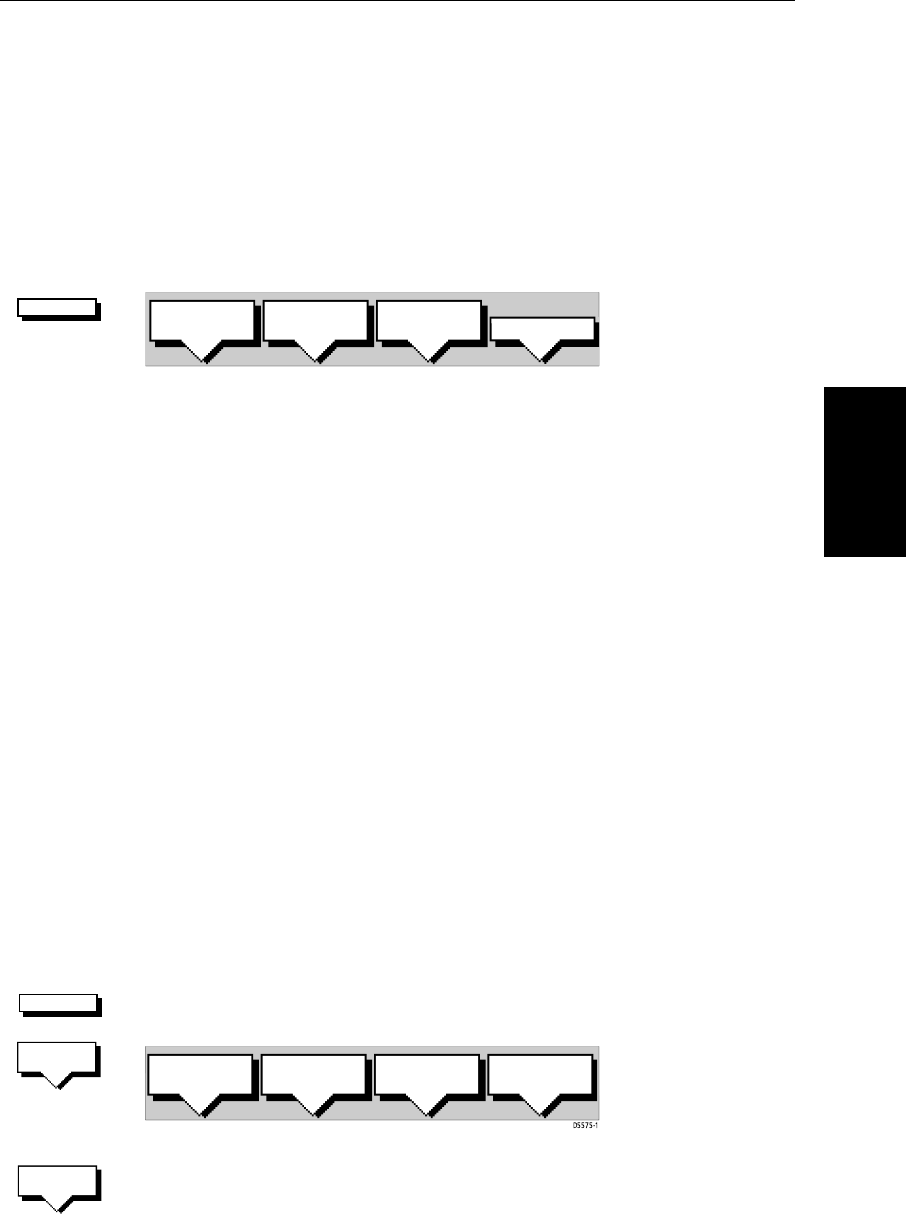
➤ To access the route soft keys, press the default soft key ROUTE:
Creating a New Route
Note: If there is a current route, it is cleared when you select MAKE ROUTE. If
you are following the current route you are prompted to
STOP FOLLOW. Press
the
YES soft key to continue, or NO to abandon route creation. If the route has
not been saved you are prompted to save it.
The chart scenario Make and Follow a Route on page 2-26 provides a simple
example of how to create a route.
There are two methods to create routes, whilst creating a route you can switch
between these methods:
• Placing new waypoints on the chart.
• Selecting existing waypoints from the Waypoint List.
You can edit a route after you have finished making it, as described in Editing
a Route on page 5-27.
➤ To make a new route by placing waypoints:
Note: You can pan the chart and change the scale while placing waypoints.
1. If necessary, move the cursor to the area in which you wish to make the
route, and select a suitable chart scale.
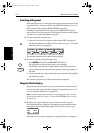
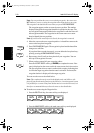
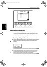
2. Press the
ROUTE soft key, then press the MAKE ROUTE soft key. The make
route soft keys are displayed:
3. Move the cursor to the position on the chart where you want your first way-
point to be. Press the
PLACE WAYPOINT soft key.
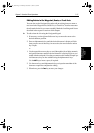
ROUTE
D4167-1A
MAKE
ROUTE
EDIT
ROUTE
CLEAR
ROUTE
MORE¬
ROUTE
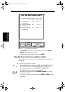
MAKE
ROUTE
PLACE
WAYPOINT
UNDO
WAYPOINT
ACCEPT
ROUTE
USE
WPT LIST
PLACE
WAYPOINT
81186_2.book Page 19 Monday, December 17, 2001 8:35 AM