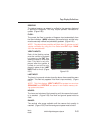
DIS/DTK:
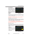
The distance in nautical miles and tenths between either the FROM
and TO waypoints or between the aircraft's present position and the
TO waypoint. The desired track is the Great Circle course between
the FROM and TO waypoints. The DTK will have a T adjacent to it if
a true heading input is received or if the FROM waypoint is north N
70° or south S 60° latitude. (Figure 2-52)
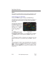
ETE:
The estimated time enroute in hours, minutes and tenths of minutes
between the aircraft's present position and the TO waypoint or the
FROM and TO waypoints based on the GS value. (Figure 2-52)
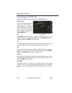
FPL:
The total active or stored flight plan distance and time remaining via the
Flight Planned route from the FROM waypoint, (or the aircraft's present
position when a Direct To leg is displayed), to the last waypoint on the
selected flight plan that precedes a "fence". Distance is displayed in
whole miles and time is in hours and minutes. (Figure 2-52)
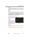
ETA @:
Estimated time of arrival at the destination, or last waypoint on the
Active Flight Plan that precedes a "fence", appears when a DIRECT
TO leg is displayed. (Figure 2-52)
NOTE: The ETA value field will turn yellow if a ground speed is
entered manually, indicating that the ETA is calculated based on the
manual ground speed value. The GS field will turn yellow and
(CALC) will be displayed if a manual ETA value is entered.
RAIM @:
Receiver Autonomous Integrity Monitoring at the last flight plan way-
point will display AVAIL (available) or NOT AVAIL (not available) at
the ETA. If a manual ground speed or ETA has been entered,
STANDBY will be displayed momentarily while the system calculates
RAIM availability. If GPS is not functioning, NO NAV will be dis-
played.
Page Display Definitions
2-45
GNS-XL Flight Management System
Rev. 0
Oct/96


