


Garmin G1000 Pilot’s Guide for the Diamond DA40/40F
190-00592-06 Rev A472
ADDITIONAL FEATURES
SYSTEM
OVERVIEW
FLIGHT
INSTRUMENTS
EIS
AUDIO PANEL
& CNS
FLIGHT
MANAGEMENT
HAZARD
AVOIDANCE
AFCS
ADDITIONAL
FEATURES
APPENDICESINDEX
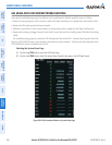
8.8 FLIGHT DATA LOGGING
The G1000 has the ability to record certain flight and engine parameters on an SD card with a maximum size of
four-gigabytes. A two-gigabyte SD card containing no other data, is capable of storing 2,000 hours of data. The
following data will automatically be recorded once every second as long as the system is operating and an SD card
resides in the top card slot of the MFD.
•ActiveWaypoint
•AttitudePitchAngle
•AttitudeRollAngle
•Autopilot(AP)Engaged
•BaroAdjustment/Correction
•Baro-CorrectedAltitude
•BatteryAMP
•BatteryVolts
•BearingtoNextWaypoint
•CarburetorTemperature
•COM1Frequency
•COM2Frequency
•CurrentPosition
•Cylinderheadtemperature,cylinders1-4
•DistancetoNextWaypoint
•EngineRPM
•ExhaustGasTemperature,cylinders1-4
•FuelFlow
•FuelPressure
•FuelQuanityLeft
•FuelQuanityRight
•GFC700PitchCommand
•GFC700PitchMode
•GFC700RollCommand
•GFC700RollMode
•GPSAltitude
•GPSAltitudeRelativetoMeanSeaLevel
•GPSFix
•GPSHorizontalAlertLimit
•GPSHorizontalProtectionLevel
•GPSVertical Alert Limit
•GPSVerticalSpeed
•GroundSpeed
•GroundTrackMagnetic
•HorizontalCDI
•HSISource
•IndicatedAirSpeed
•Lateral/Y/RightAcceleration
•Local24hrTime
•LocalDate
•MagneticHeading
•MagneticVariation
•ManifoldPressure
•NAV1Frequency
•NAV2Frequency
•Normal/Z/UpAcceleration
•OilPressure
•OilTemperature
•OutsideAirTemperature
•SelectedCourse
•TrueAirspeed
•UTCTime
•VerticalCDI
•VerticalSpeed
•WAASGPSHorizontal Protection Level
•WAASGPSVertical Protection Level
•WindDirection
•WindSpeed