


3-61
Rev 1
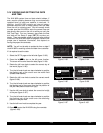
While the display menu is displayed, select the track
up map orientation (TK) as well. Pressing the right C
again removes the menu from the screen. You select
the 30 nm range scale on the left side using the left
C and left knobs. You also decide to display ETE,
DTK, and TK on the left side of the map display by
using the left knobs.
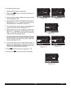
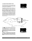
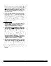
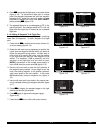
6. Since it is a good idea to not rely on just one naviga-
tion source, you decide to cross check the KLN 90B
position against other equipment in the aircraft. The
NAV 2 page indicates you are presently located on the
Texarkana (TXK) VOR 68 degree radial at a distance
of 19 nautical miles. By tuning your Navigation
Receiver and DME to TXK, you are able to confirm
that this is the correct position.
3.18.3 Terminal Area
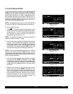
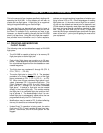
1. About 50 nautical miles from Austin’s Mueller airport
you start preparing for your arrival. Viewing the APT 4
page for KAUS you determine that the ATIS fre-
quency is 119.20 MHz and tower is 121.00 MHz.
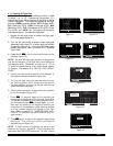
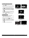
2. A few minutes later, the message prompt begins flash-
ing. When you press M, the message page advises:
AIRSPACE ALERT - AUSTIN CL C - SEE KAUS
APT 4 PAGE BELOW 4600 FT. The Special Use
Airspace Alert feature has determined that you are
within 10 minutes of penetrating the Austin Class C
airspace. When you view the APT 4 page, you see
that the Class C airspace frequencies are sectorized.
You determine from the APT 4 page that the proper
frequency to use is 124.90 MHz since you are
Northeast of Austin and 124.90 MHz is the appropriate
frequency to use from 3 degrees to 170 degrees.
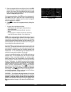
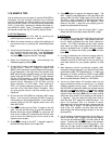
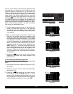
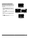
3. After you call Austin approach control for clearance
into the Class C airspace, you view the rest of the
APT pages for KAUS to determine the field elevation
and available runways. The first APT 3 page shows
you a runway diagram for the airport.
4. After landing, the KLN 90B is turned off either by
pulling the power/brightness switch to the “out” posi-
tion or with the avionics master switch if one is
installed.