


Chapter 6: Using Platinum cartography 53
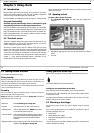
information in the status bar is now shown in brackets to indicate planning
mode has ben selected.
Clicking the FIND SHIP soft key reTurns the application to active motion
mode, in the default view, showing the chart in the forward looking view
at your current position.
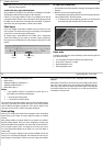
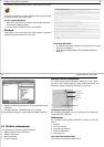
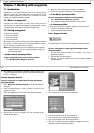
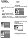
Using 2D and 3D charts together
If the area in which you are navigating is unfamiliar to you, or visibility is
poor, working with 2D and 3D chart applications on the screen side by side
can give you extra confidence and help you to find out what is around you.
With your RayTech page set up to view the two applications together a
comprehensive view of the surrounding area is show.
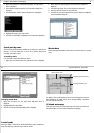
As with all multiple page sets the active window is indicated by a red
border. To make any changes in an application it must be the active
window.
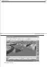
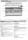
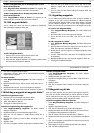
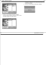
Navigating with 3D Charts
To navigate to a new waypoint or use a new route, you should first create
the waypoint or route on your 2D chart.
Once navigation is activated in the normal way, the 3D chart displays:
• The active waypoint using the same symbol as the 2D chart.
However, it should be remembered that a route can only be edited using a
2D chart. Any changes that you make on the 2D chart are automatically
shown on the 3D chart.
54 RayTech RNS V6.0 - Users Guide