


Chapter 6: Using Platinum cartography 43
Chapter 6: Using Platinum cartography
6.1 Introduction
The Navionics Platinum Chart card used in conjunction with RayTech
enables you to access enhanced 2D cartography and 3D bathymetric
charts.
These features will give you an accurate, easy to view image of the area
around your boat, giving you confidence in knowing where you are and
what is around you, enabling you to plan in detail where you want to go.
Operation of these charts and their features is similar to the way in which
existing chart cards are used.
2D cartography
The Platinum chart card enhances many of the chart features found on
other Navionics chart cards and introduces new ones making additional
features available.
Enhanced features
• Additional business services information - enabling you to find local
restaurants, shops and places of interest in addition to marina services.
• Additional wrecks data - a new set of wrecks and their associated data.
• Major coastal roads - can now be displayed on a 2D chart.
• US inland waterways - enables you to view major navigable lakes, e.g.
Great Lakes, Lake Okeechobee.
New features
• Panoramic photos - for many ports and marinas on the chart.
• Pilot book information - an on-screen version of almanac information
for many ports.
• Aerial photo overlay - enabling you to overlay the on-screen chart with
an aerial image of coastal waters and land, making it easier to identify
objects and cartographic features.
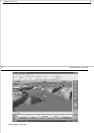
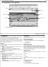
3D bathymetric charts
The 3D bathymetric chart application introduces an easy-to-use chart
format that provides a graphical view of land and sea contours around your
boat. Much of the information available on a conventional chart can be
shown in three dimensions, giving you an accurate, easy-to-view image of
the area around your boat that can help you plan:
• Fishing spots.
• What fishing pattern to use.
• Safe routes.
If you are in a new area or visibility is poor, 3D cartography can help to give
you the confidence to know where you are and what is around you. You
can also show active waypoints and routes on a 3D chart.
3D cartography has the following features:
• Choice of operating modes - Active or planning.
• Ability to change the view point.
• 360
o
rotation of the selected view.
• Vertical exaggeration of the view.
• Ability to view water depth.
• Ability to indicate the area which your fishfinder transducer cone
covers (if fitted).
• Ability to overlay Navionics aerial photographs.
44 RayTech RNS V6.0 - Users Guide
6.2 New 2D chart features
The new 2D features of the Navionics Platinum chart card include:
• Aerial photo overlay.
• Panoramic photos.
• Pilot book information.
All of these chart features are accessed using the normal controls and soft-
keys of RayTech.
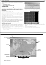
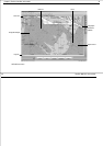
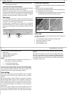
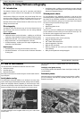
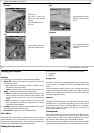
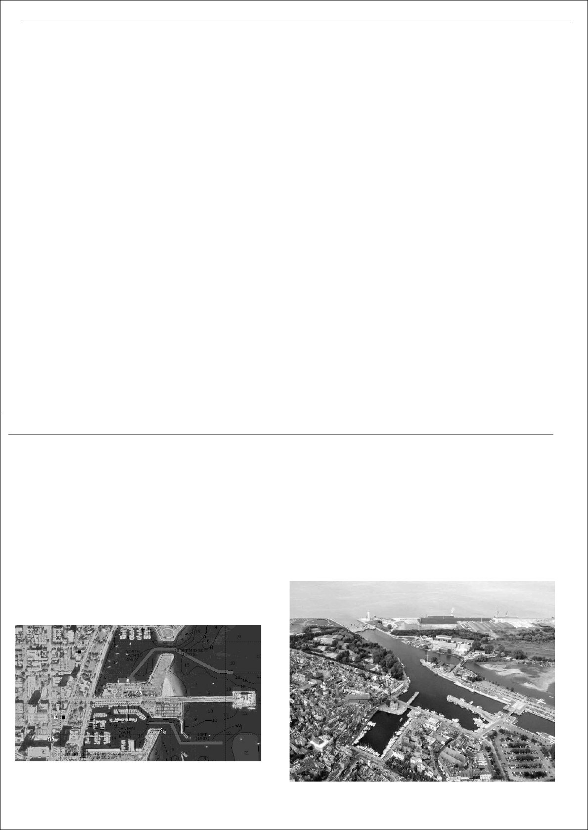
Aerial photo overlay
The aerial photo overlay will enables you to overlay the on-screen chart
with an aerial image of coastal waters and land, making it easier to identify
objects and cartographic features. Depending on the area that your chart
covers the aerial overlay is either full color or black and white. The level of
features and objects shown also varies dependent on the area covered.
The aerial photograph covers navigable waters and up to 3 miles inland
from the coast.
You can adjust the level of visibility between the chart and the aerial
photograph.
To display aerial photo overlay:
In the Charting toolbar click Navionics Photos. Aerial photo overlay will
now be displayed.
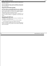
Panoramic photos
Panoramic photos are now available for many ports and marinas, enabling
you to see what the area looks like, especially valuable if you have not
visited this area before.
D
7923_1
D8755_1