


Chapter 13: RayTech advanced features 135
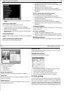
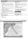
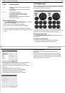
Optimum route
Navigation numbers
D7039_1
136 RayTech RNS V6.0 - Users Guide
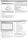
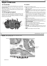
13.9 Navigation numbers
You can use the navigation numbers feature of RayTech - see “Navigation
numbers” on page 135 to display data collected from your boat’s instru-
ments and adjust it in a ‘What happens if’ scenario to optimize
performance.
Using the ‘What if’ page you can make an assumption about what the wind
will do and enter this into RayTech. Alternative laylines are then calculated
and the information shown on screen allowing you to decide the best
course to take. True wind direction and speed are calculated in short (30
second) and long (10 minute) averages.
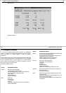
Information available includes:
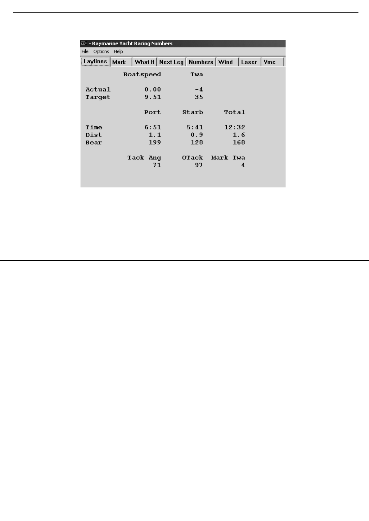
Screen Information and use
Laylines Boat speed - actual and target
True wind angle - actual and target
Port layline/Starboard tack - time, distance and bearing
Total - time, distance and bearing to mark
Tacking angle
Other tack heading
Mark true wind angle
Mark Mark range
Mark bearing
Cross track error
Leg range
Whole route - length, distance to go, time to destination
and ETA at destination
What if Permits you to enter assumptions about what the wind will
do and calculate alternative laylines
30 second (short) and 10 minute (long) averages for true
wind direction and sure wind speed
Numbers updated using current position data
Layline data displayed for data comparison
Next Leg Time on tack - port and starboard
Tack heading - port and starboard
Leg length
Leg bearing
Target boat speed
Target true wind angle
Leg bias (true wind if heading directly at the mark)
Numbers Used to verify that GPS and instruments are functioning
Key instrument data
Internally calculated data
Wind Used to view wind averages over different periods, wind
trending and shift
Samples true wind direction and true wind speed in 2, 5, 10,
30, 60 and 120 minute samples
Gives overall5 minute average of true wind speed ad true
wind direction
Screen Information and use